


FOLLOW THE RAIN
The art of
managing stormwater in
Minneapolis
FEATURED SITE
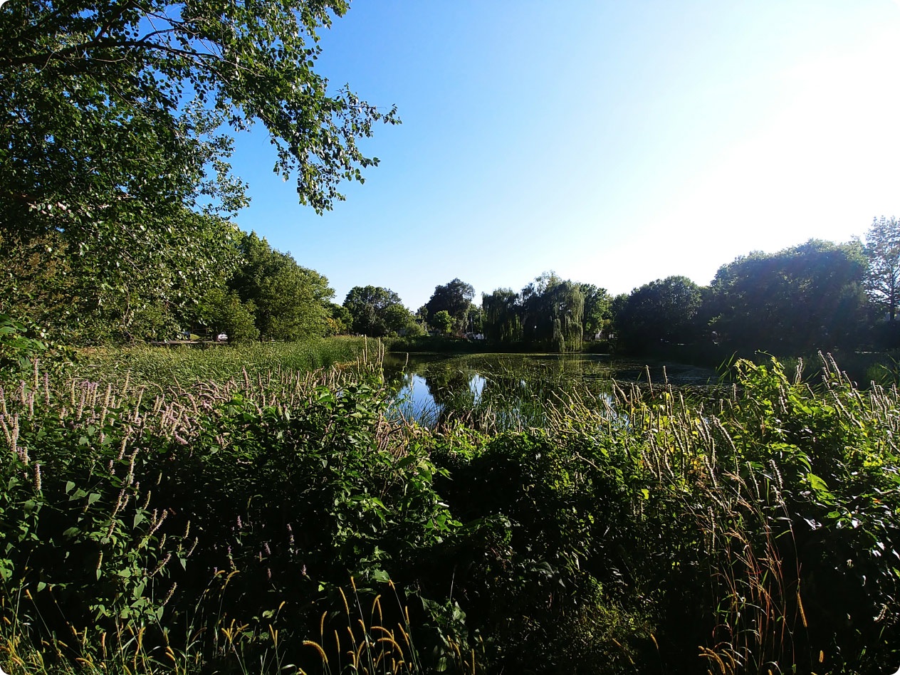
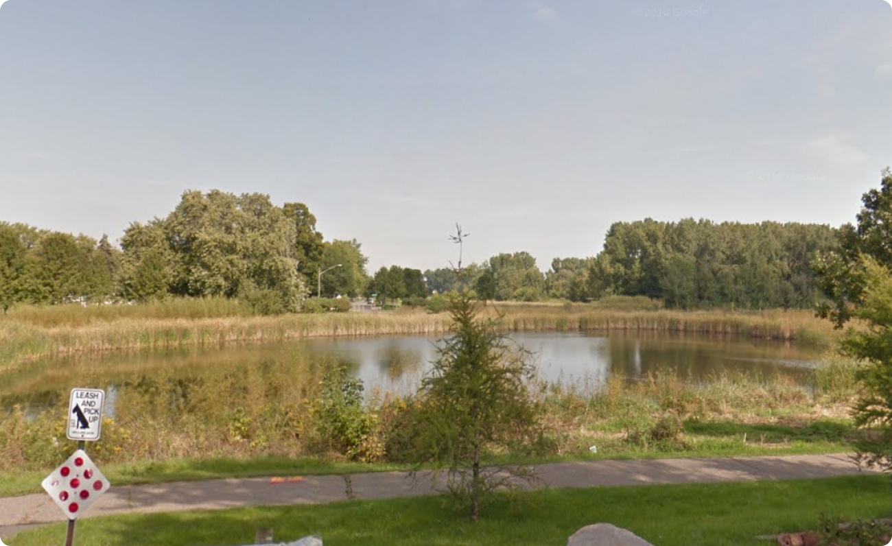
PARK AVENUE PONDS

EXPLORE PARK AVENUE PONDS
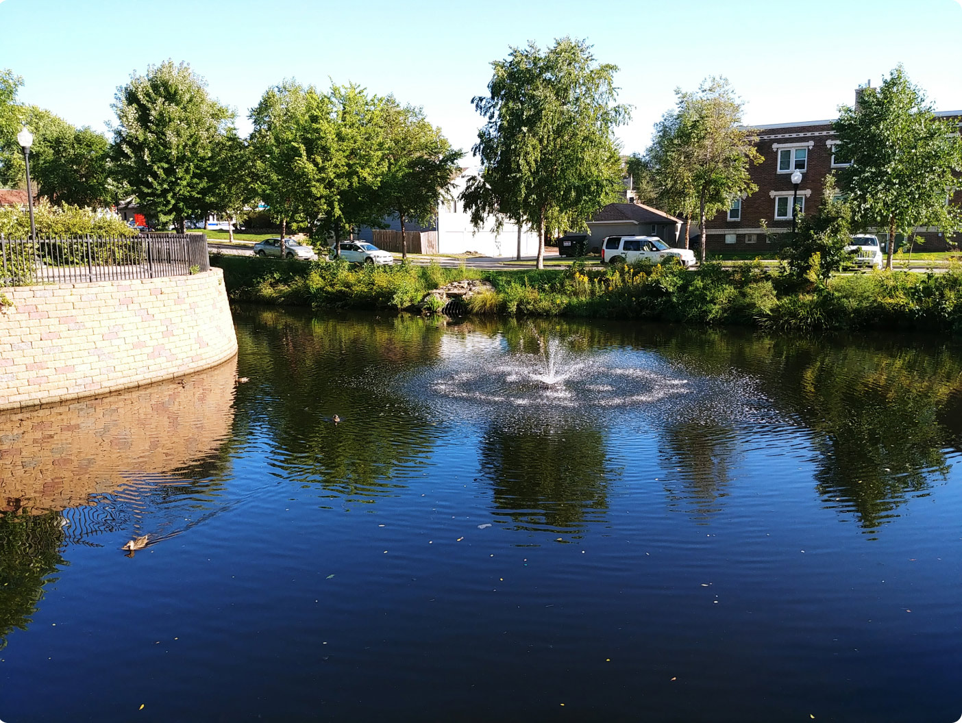
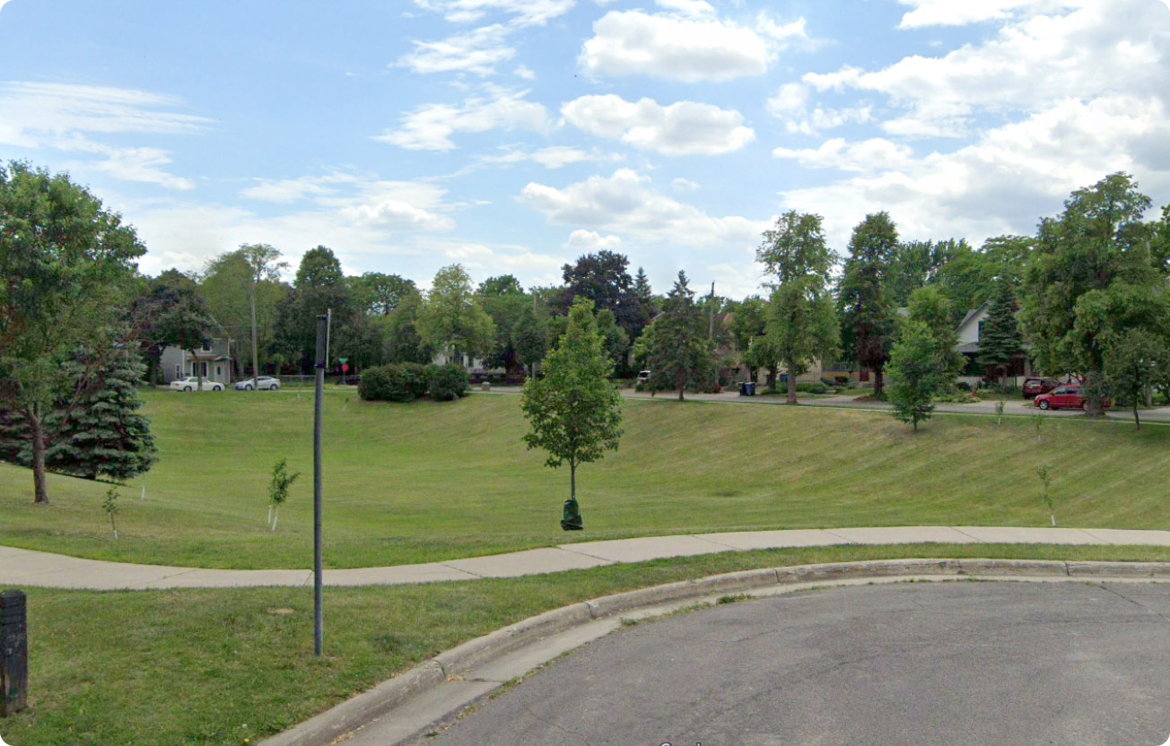
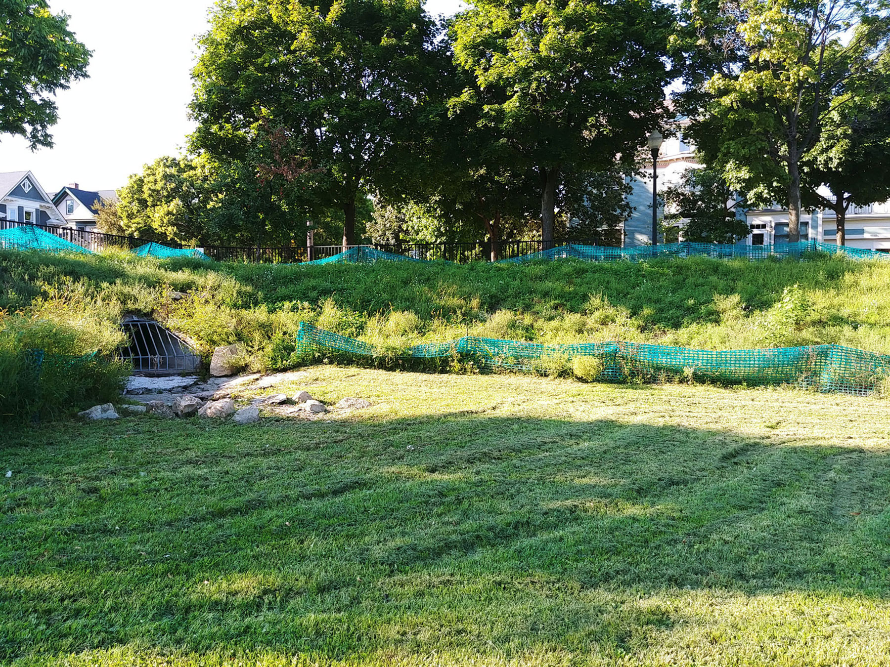
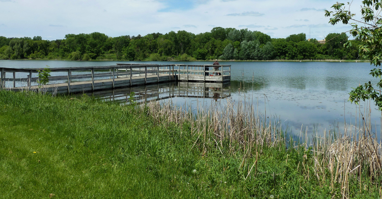
You are near: SHINGLE CREEK POND


About the ponds
Explore nearby...

About Minneapolis Stormwater Sites
We have ponds, raingardens, and infiltration basins (also called dry ponds) installed throught the City to help clean up rainwater runoff, control flooding, and slow down water flow when it rains.


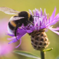
BUZZ BUZZ!
 BUZZ BUZZ!
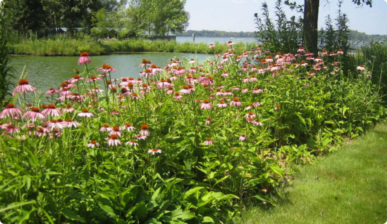
We also care about our pollinator friends! We have planted pollinator gardens throughout the City.

 Next closest site
 All Sites
 Get Involved
PARK AVENUE PONDS
There are 3 signs to explore at this site
More than just a pond
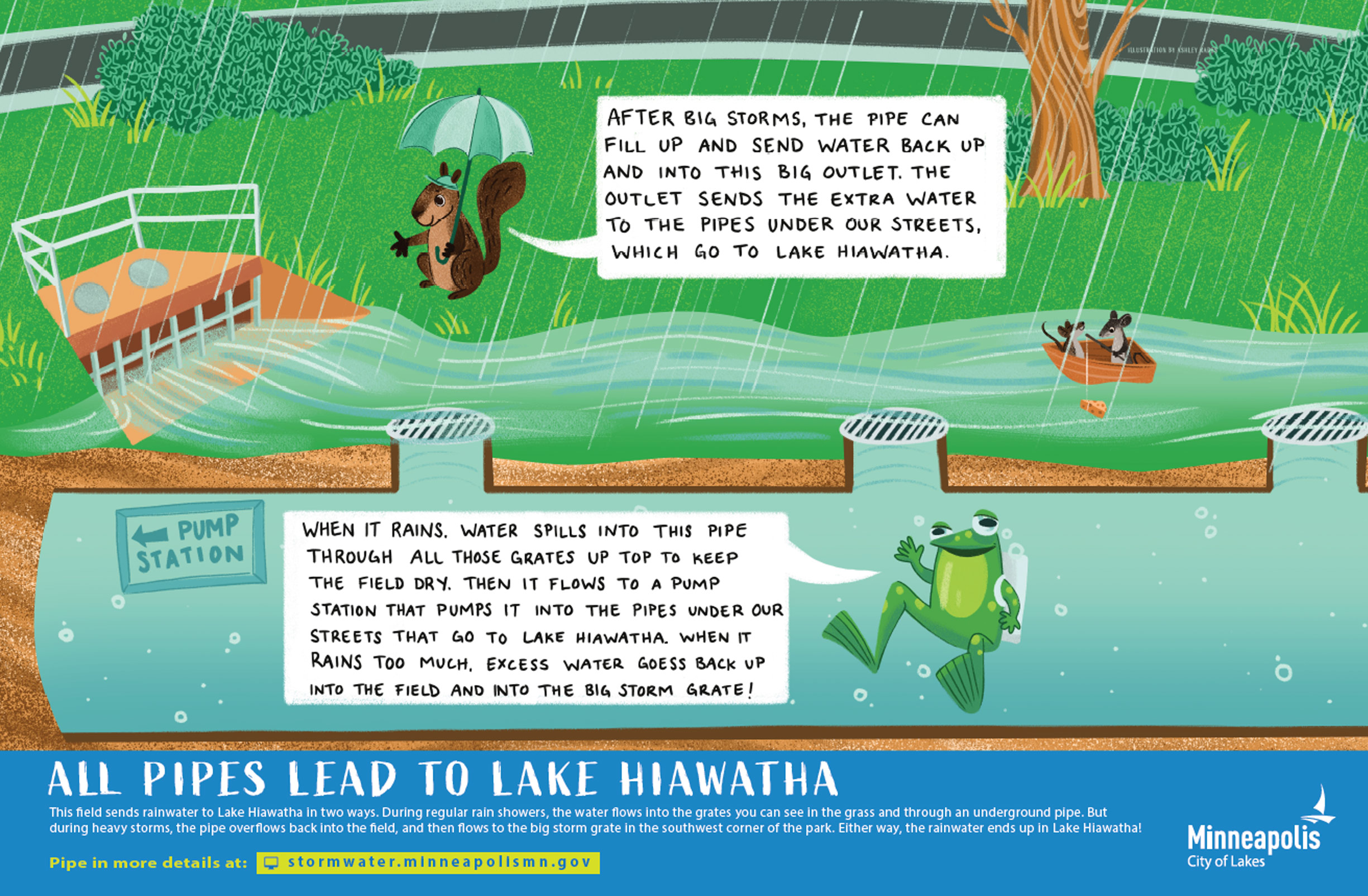
The two ponds on 43rd and 44th Street are all about teamwork. The 43rd Street pond takes in runoff from streets and yards after it rains to keep the neighborhood dry and clean up garbage and muck. But when the 43rd Street pond has too much water, it sends some over to the 44th Street pond so everything stays balanced. The 44th Street pond cleans up the water even more and sends onto Minnehaha Creek.
Learn more about what this site does:
Remove sediment
LEARN MORE
Slow down flow
LEARN MORE
Helps pollinators
LEARN MORE
Reduce flooding
LEARN MORE
 Remove sediment
 Slow down flow
 Helps pollinators
 Reduce flooding
KEY FACTS:
| Drains to: | Minnehaha Creek, then to the Mississippi River |
|---|---|
| Watershed: | Minnehaha Creek Watershed District |
| Sediment removed: | 14,000 lbs |
| Phosphorous removed: | 30 lbs |
| Related projects: |
Coming soon |
| History & Culture: | City of Minneapolis Water Resources Land Acknowledgment |
SIGNS AT THE SITE

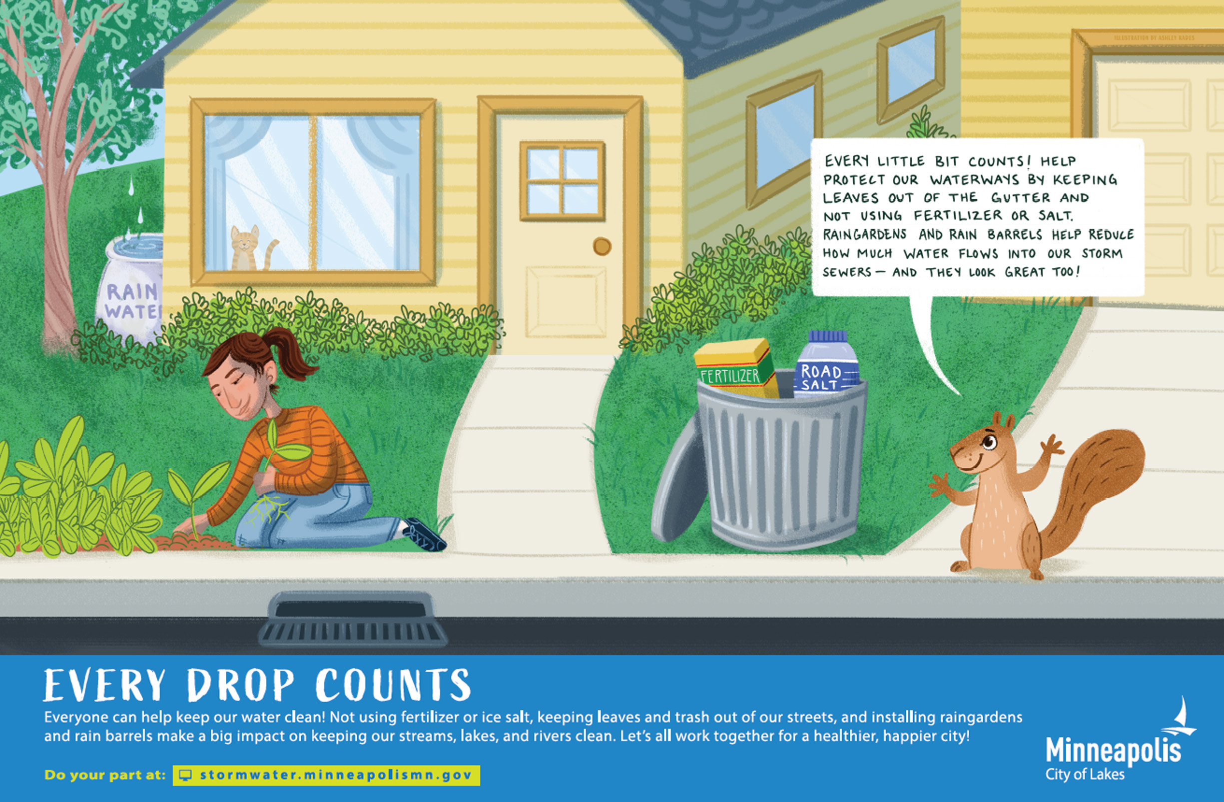
IMAGE GALLERY


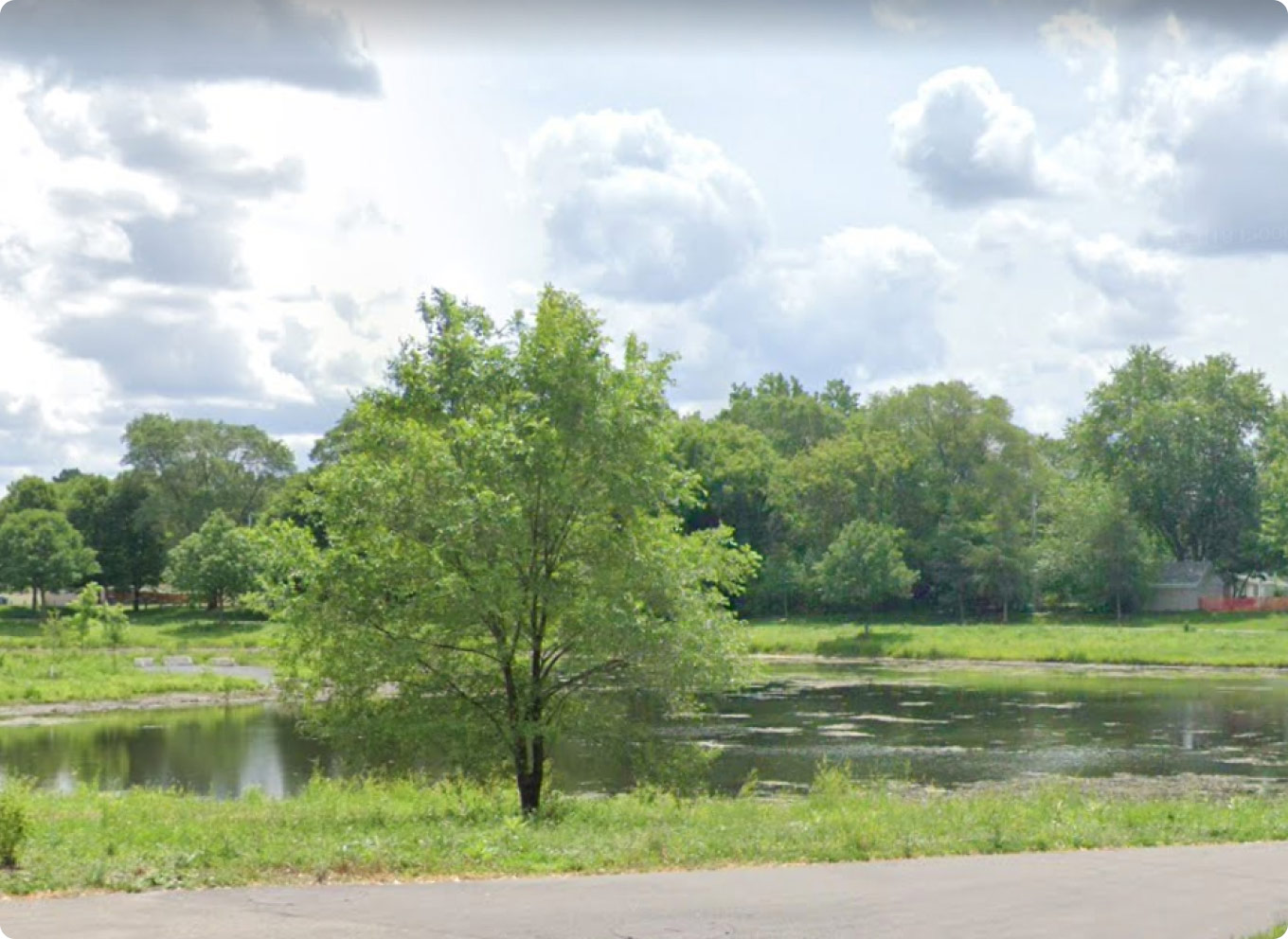
MEMORIAL PONDS
There are 3 signs to explore at this site
More than just a pond and field
The Memorial Pond and Field are your neighborhood superhero and trusty sidekick. On normal dry days, they are a pretty duck pond and a grassy field. But when it rains, they transform! The pond takes the lead by grabbing garbage and sediment. The field springs to action if there is too much rain for the pond - the extra water overflows into the field where its absorbed and cleaned up even more. All this in the name of sending clean water to Minnehaha Creek at a slow and steady pace.
Learn more about what this site does:
Remove sediment
LEARN MORE
Slow down flow
LEARN MORE
Reduce volume
LEARN MORE
Reduce flooding
LEARN MORE
Helps pollinators
LEARN MORE
 Reduce volume
KEY FACTS:
| Drains to: | Minnehaha Creek, then to the Mississippi River |
|---|---|
| Watershed: | Minnehaha Creek Watershed Distrct |
| Sediment Removed: | 4,500 lbs |
| Prosphorus Removed: | 10 lbs |
| Related projects: |
Coming soon |
| History & Culture: | City of Minneapolis Water Resources Land Acknowledgment |
SIGNS AT THE SITE

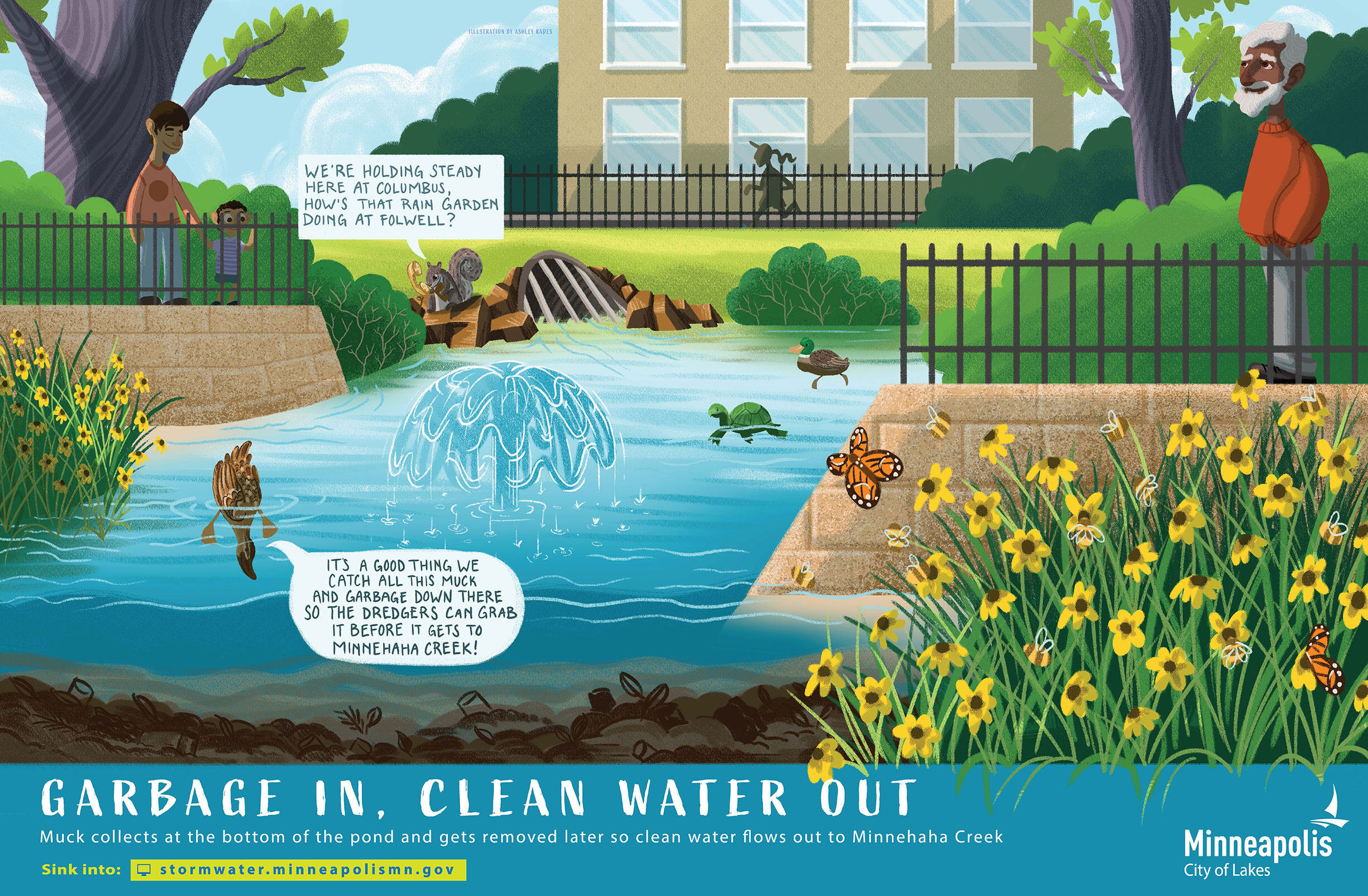

IMAGE GALLERY

FOLWELL INTERPRETIVE BASIN
There are 3 signs to explore at this site
More than just a garden
Folwell’s very own secret garden! It’s a place for kids to explore and play, but its colorful plants are hard at work drinking up rainwater through their roots and gobbling up nutrients like nitrogen and phosphorous that are yummy for plants but icky for our streams and rivers.
Learn more about what this site does:
Remove nutrients
LEARN MORE
Slow down flow
LEARN MORE
Reduce volume
LEARN MORE
Helps pollinators
LEARN MORE
 Remove nutrients
KEY FACTS:
| Drains to: | Minnehaha Creek, then to the Mississippi River |
|---|---|
| Watershed: | Minnehaha Creek Watershed District |
| Sediment removed: | 500 lbs |
| Phosphorous removed: | 1 lb |
| Related projects: |
Coming soon |
| History & Culture: | City of Minneapolis Water Resources Land Acknowledgment |
SIGNS AT THE SITE
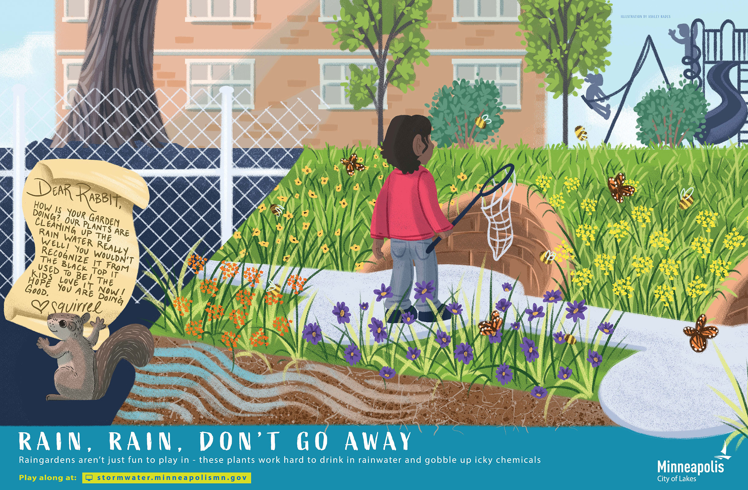
IMAGE GALLERY

MINNEHAHA CREEK OUTLET
There is 1 signs to explore at this site
The signs at this site are not yet installed, but will be coming soon! The sign locations shown on the map are subject to change
 Navigate to this site

More than just a pipe
The Minnehaha Outlet conveys water from Minnehaha creek, which has been cleaned, slowed, and controlled by the ponds, basins, and raingardens upstream, into the Mississippi River.
Learn more about what this site does:
KEY FACTS:
| Drains to: | Directly to the Mississippi River |
|---|---|
| Watershed: | Mississippi Watershed Management Organization |
| Related projects: |
Coming soon |
| History & Culture: | City of Minneapolis Water Resources Land Acknowledgment |
SIGNS AT THE SITE
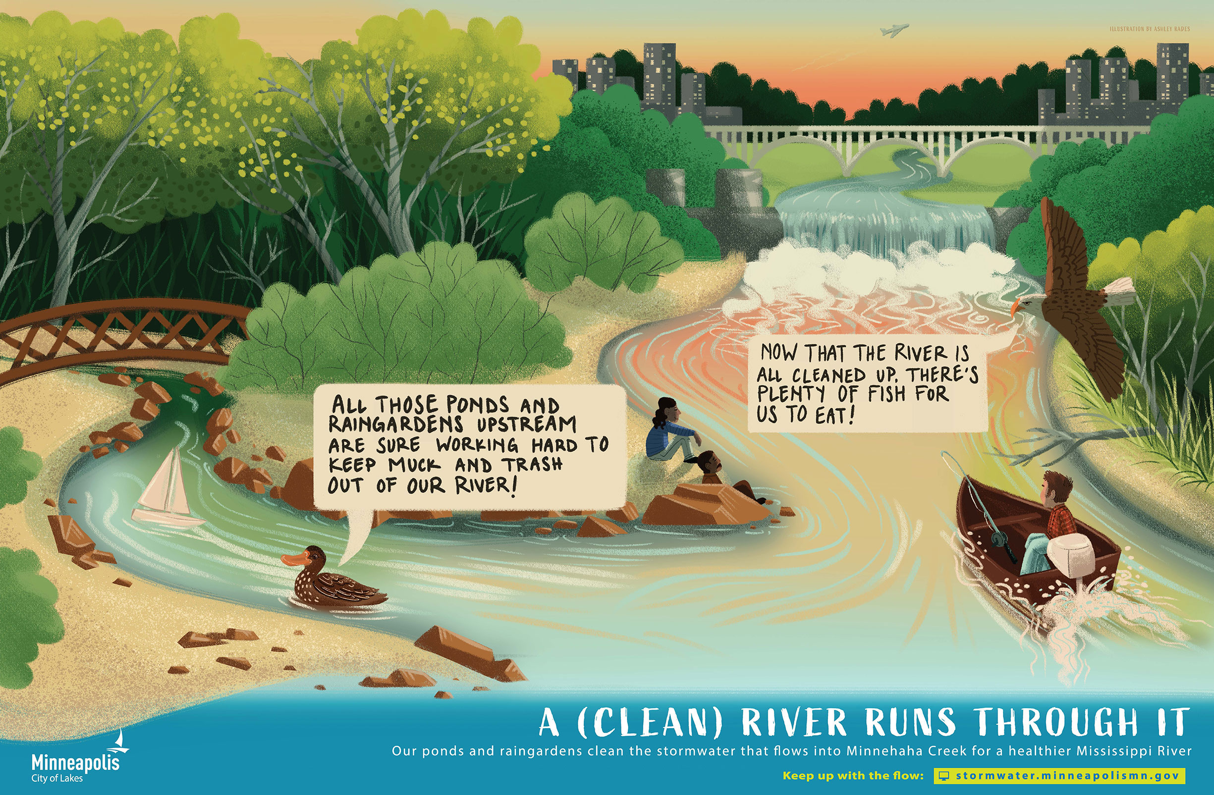
IMAGE GALLERY
LOGAN PONDS
There are 3 signs to explore at this site
More than just a pond
Logan Pond keeps its surrounding neighborhoods dry by taking in runoff after it rains. It also does a lot of hard work cleaning up that runoff by removing sediment and garbage before sending it on at a slow and steady pace to Bassett Creek.
Learn more about what this site does:
Remove sediment
LEARN MORE
Slow down flow
LEARN MORE
Reduce flooding
LEARN MORE
Helps pollinators
LEARN MORE
KEY FACTS:
| Drains to: | Bassett Creek, then to the Mississippi River |
|---|---|
| Watershed: | Bassett Creek Water Management Commission |
| Sediment removed: | 17,000 lbs |
| Phosphorous removed: | 40 lbs |
| Related projects: |
Coming soon |
| History & Culture: | City of Minneapolis Water Resources Land Acknowledgment |
SIGNS AT THE SITE
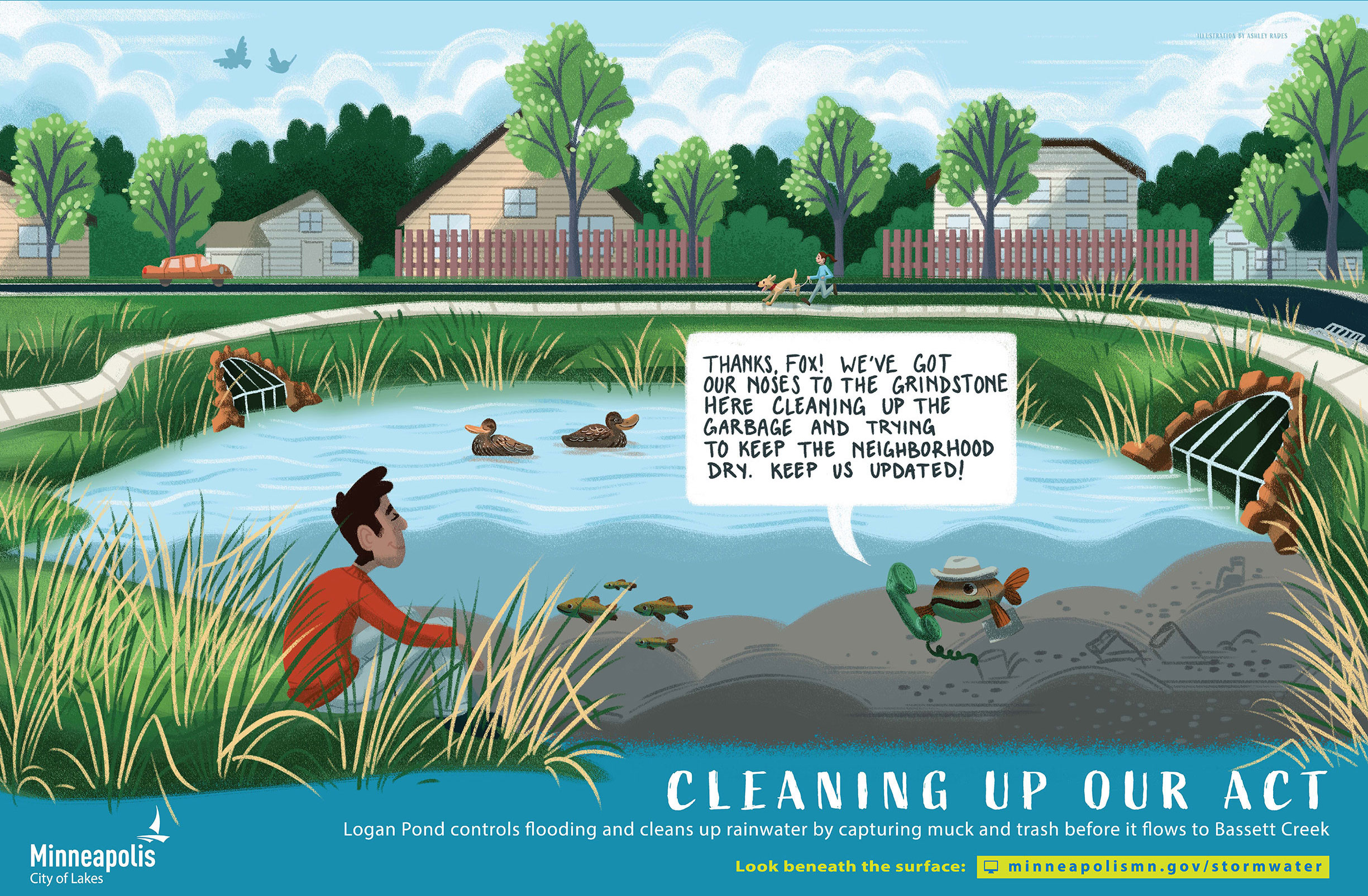

IMAGE GALLERY
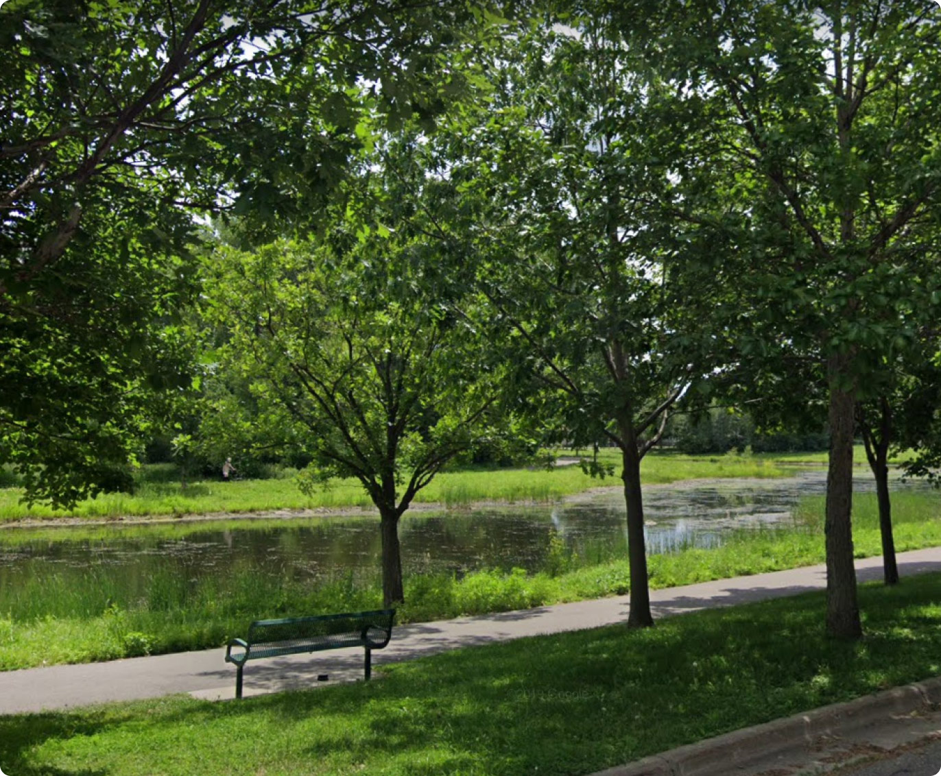
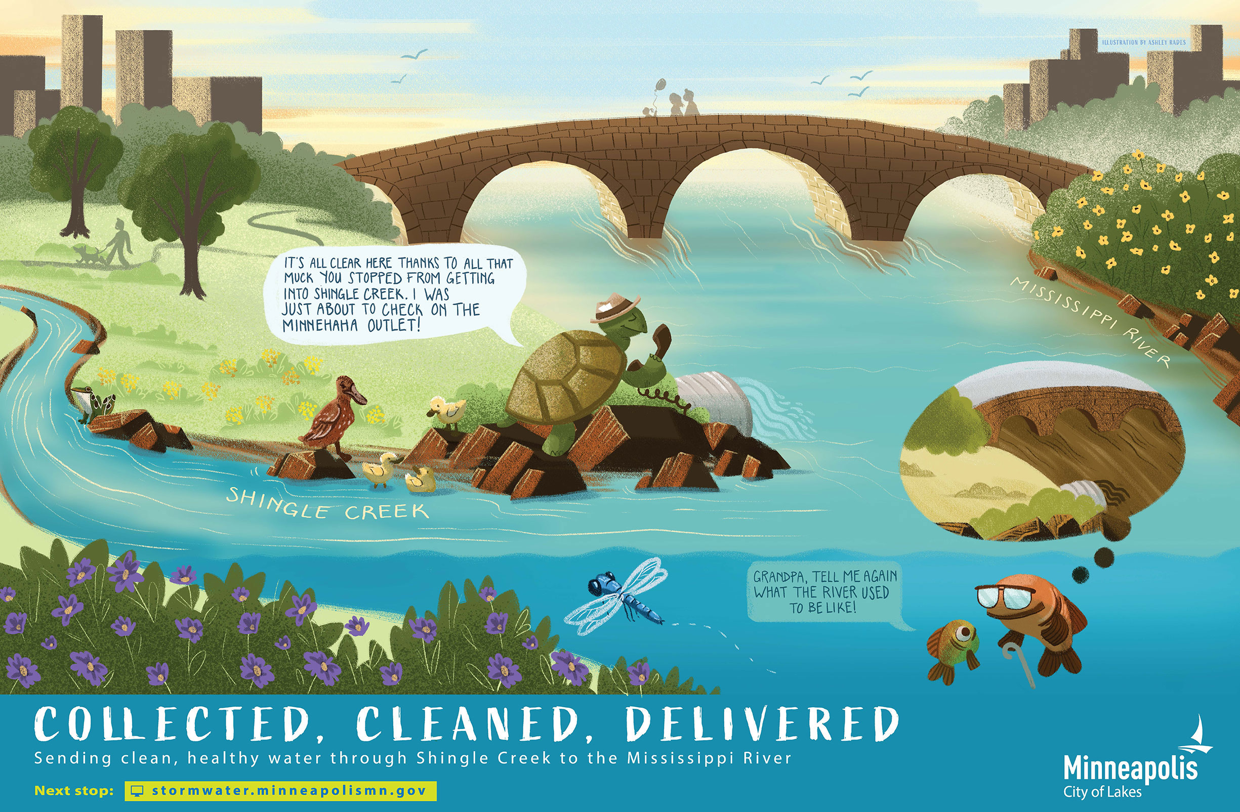
SHINGLE CREEK PONDS
There are 3 signs to explore at this site
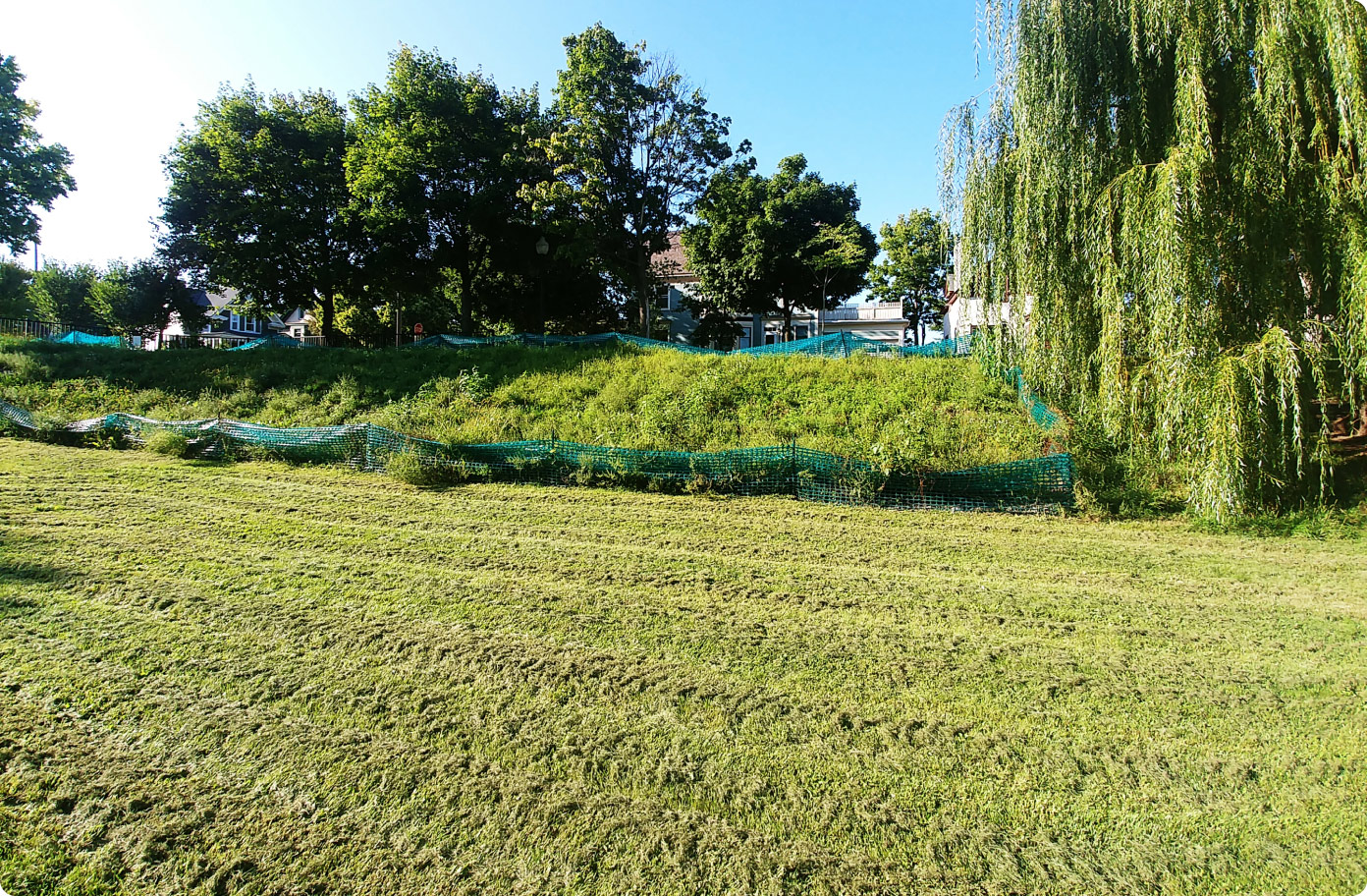
Vegetation maintenance starting in April 2025!

We're using black plastic to remove burdock without herbicide. This method is called “solarization.” The plastic stops plants from growing and heats the soil to kill burdock. Learn more!
What to expect:
- The plastic will remain throughout the 2025 growing season.
- We will replant these areas with native vegetation after full removal of the invasive species in the following years.
Questions? Call 311 For more information or other questions, contact: Paul.chellsen@minneapolismn.gov
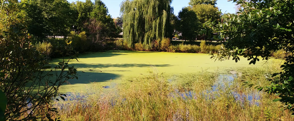
More than just a pond
The Shingle Creek ponds are always on cleanup duty, rain or shine! These two ponds work together to make sure that when it rains, floods don’t happen, muck gets removed, and clean water is delivered to Shingle Creek at a slow and steady pace.
Learn more about what this site does:
Remove sediment
LEARN MORE
Slow down flow
LEARN MORE
Reduce flooding
LEARN MORE
Helps pollinators
LEARN MORE
KEY FACTS:
| Drains to: | Shingle Creek, then to the Mississippi River |
|---|---|
| Watershed: | Shingle Creek Water Management Commission |
| Sediment removed: | 12,000 lbs |
| Phosphorous removed: | 30 lbs |
| Related projects: |
Coming soon |
| History & Culture: | City of Minneapolis Water Resources Land Acknowledgment |
SIGNS AT THE SITE
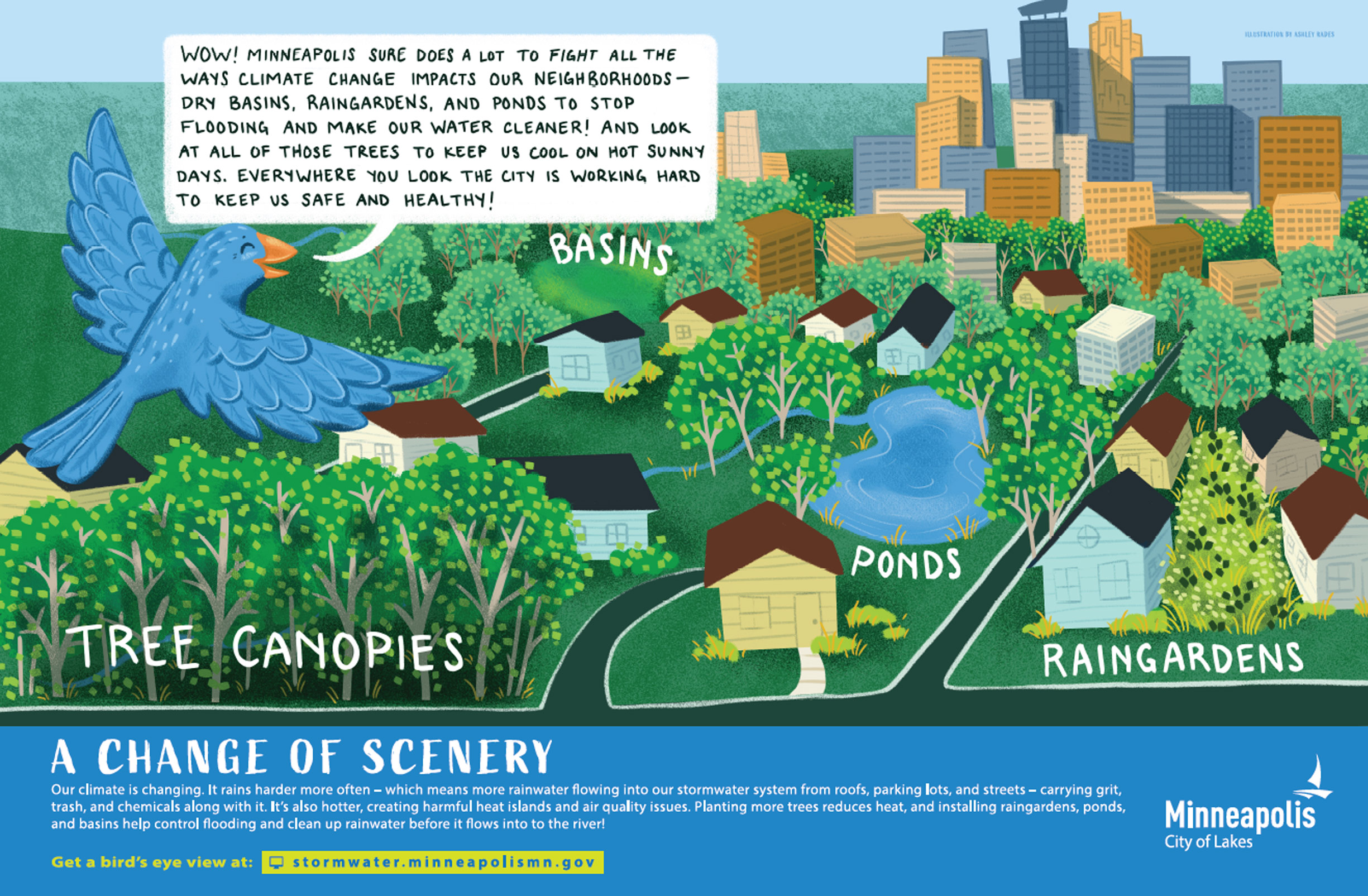
IMAGE GALLERY
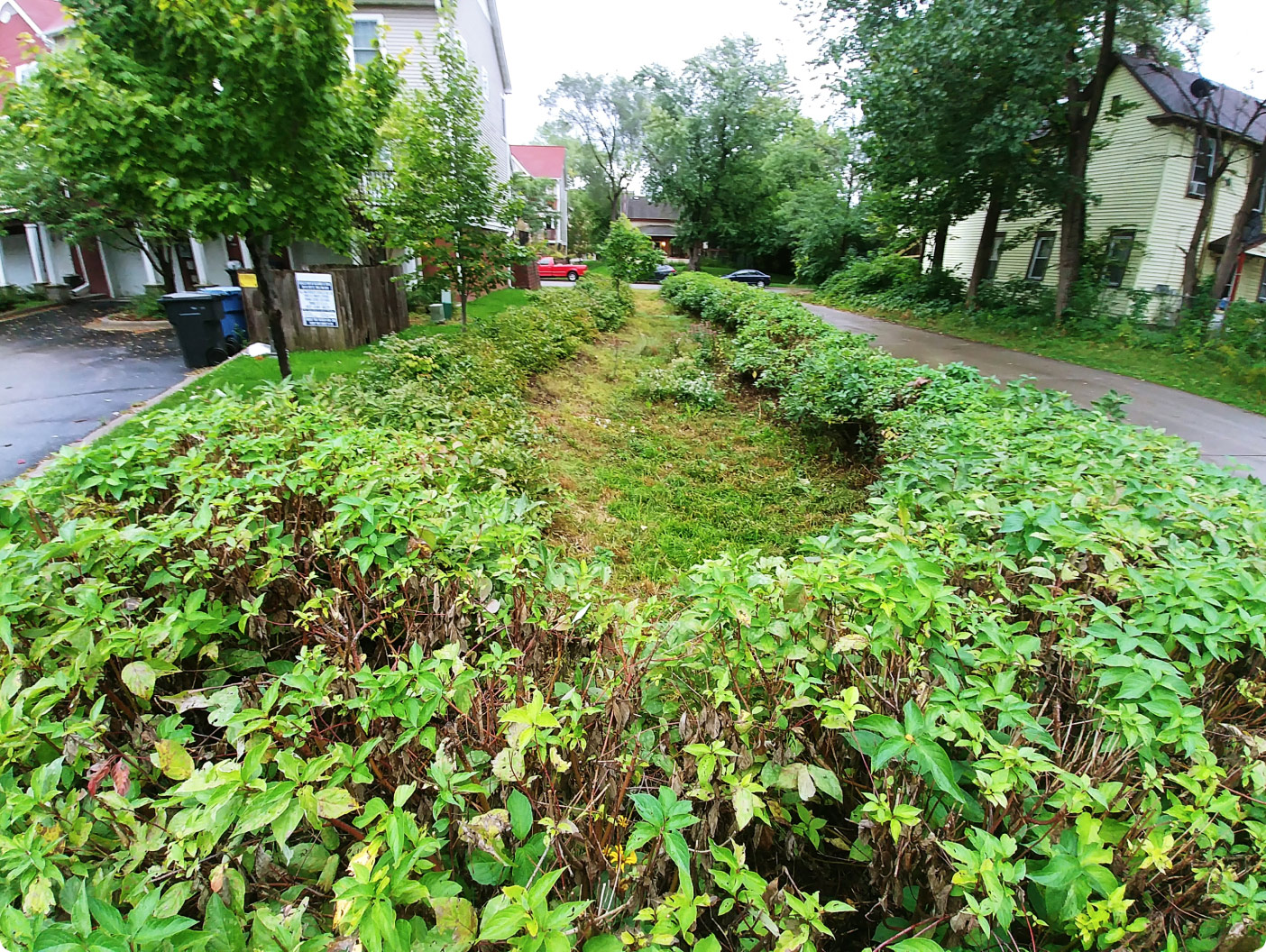
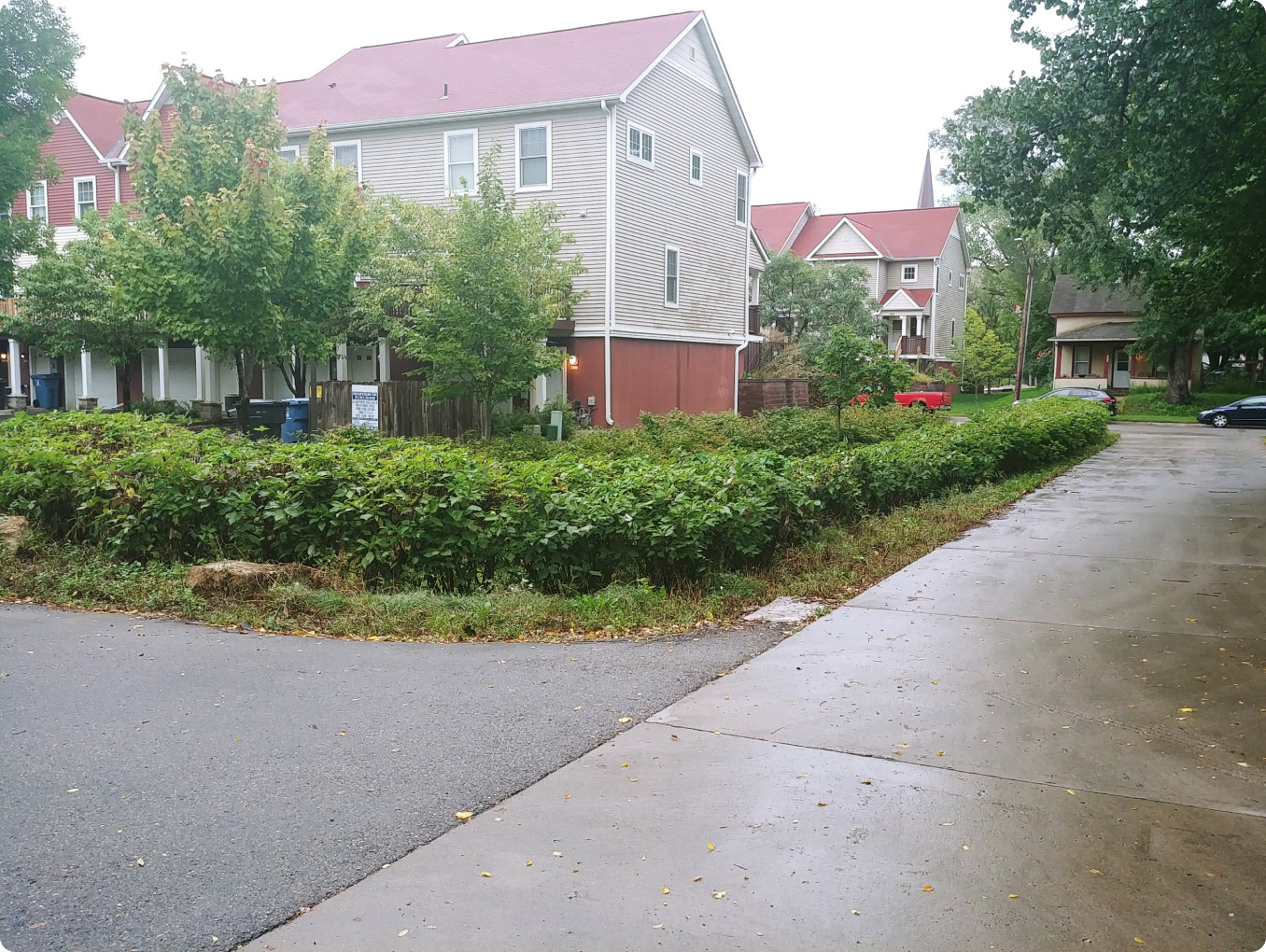
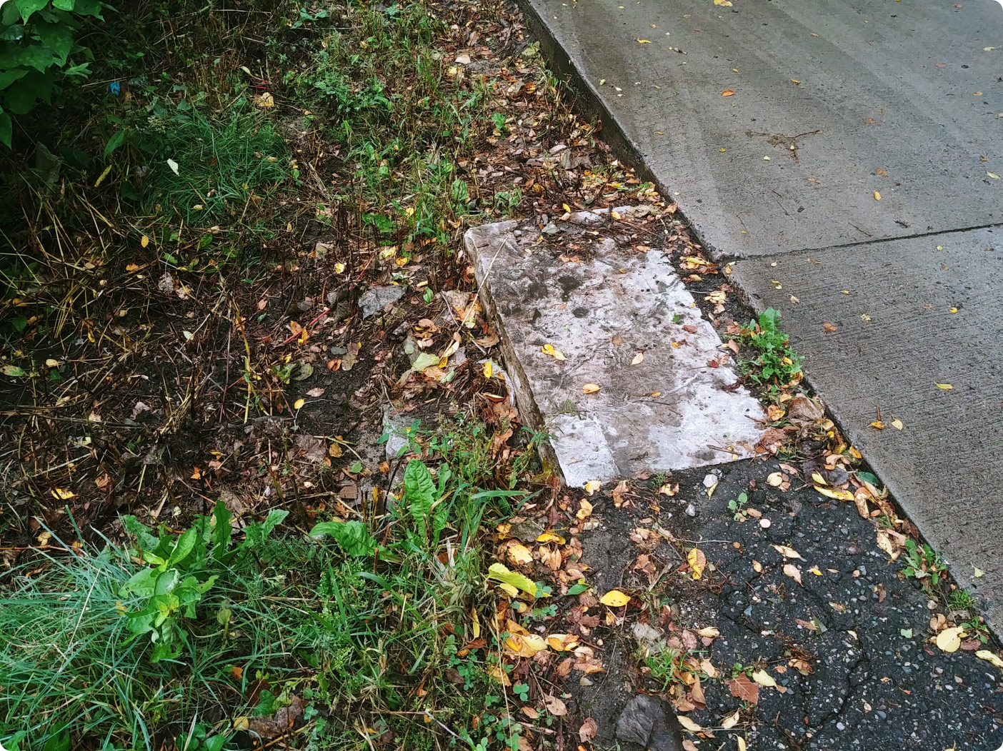
PHILLIPS NEIGHBORHOOD RAIN GARDEN
There are 3 signs to explore at this site
More than just a garden
The Phillips Neighborhood Rain Garden keeps a low profile, but it does a lot of important work! Its plants are hard at work drinking up rainwater through their roots, and gobbling up nutrients like nitrogen and phosphorous that get into rainwater runoff from our yards and streets so that they don’t flow into the Mississippi River.
Learn more about what this site does:
KEY FACTS:
| Drains to: | Directly to the Mississippi River |
|---|---|
| Watershed: | Mississippi Watershed Management Organization |
| Sediment removed: | 400 lbs |
| Phosphorous removed: | 1 lb |
| Related projects: |
Coming soon |
| History & Culture: | City of Minneapolis Water Resources Land Acknowledgment |
SIGNS AT THE SITE
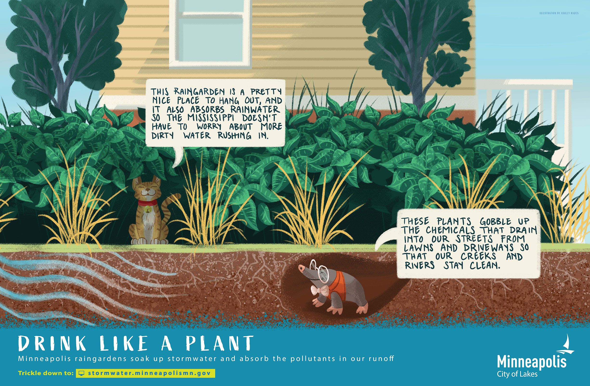
IMAGE GALLERY
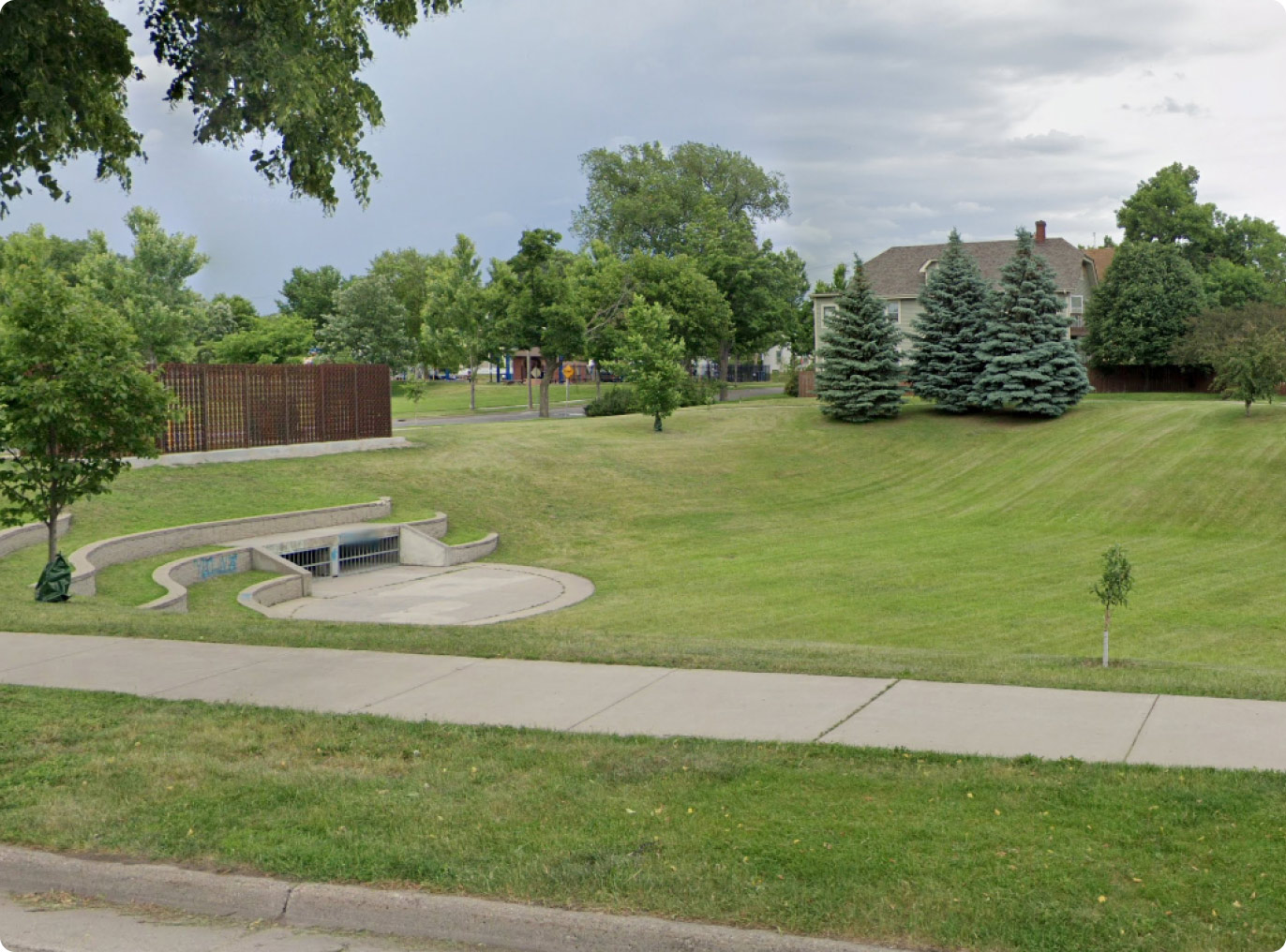
HOLLAND BASIN
There are 3 signs to explore at this site
More than just a field
The Holland Ave infiltration basin is more than just a grassy field and neighborhood amphitheater. When it rains, this hardworking basin collects and holds rainwater, so it doesn’t flood the neighborhood around it. Then it slowly absorbs it, cleaning it up and sending a nice, slow flow of water to the Mississippi River.
Learn more about what this site does:
Remove sediment
LEARN MORE
Slow down flow
LEARN MORE
Reduce volume
LEARN MORE
Reduce flooding
LEARN MORE
KEY FACTS:
| Drains to: | Directly to the Mississippi River |
|---|---|
| Watershed: | Mississippi Watershed Management Organization |
| Related projects: |
Coming soon |
| History & Culture: | City of Minneapolis Water Resources Land Acknowledgment |
SIGNS AT THE SITE

IMAGE GALLERY

BANCROFT PONDS
There are 0 signs to explore at this site
Pond maintenance starting in April 2025!
As the City's first traditional flood pond, Bancroft Pond is beginning to show its age. After 35 years of service, the pond is long due for some restoration and improvements.
What to expect:
Beginning in mid-April, 2025, we will be performing the following updates:
- dredging approx. 1,000 cubic yards of accumulated sediment
- replacing pathways and bollards
- updating the outlet structure
- repairing fencing
- vegetation maintenance and upgrades
- removing bus shelter
- stabilizing slopes
Concerns? Call 311 For more information or other questions, contact: Paul.chellsen@minneapolismn.gov
Learn more about what this site does:
KEY FACTS:
| Drains to: | Lake Hiawatha during normal rain storms, but Minnehaha Creek during big rain storms |
|---|---|
| Watershed: | Minnehaha Creek Watershed District |
| Related projects: |
Coming soon |
| History & Culture: | City of Minneapolis Water Resources Land Acknowledgment |
SIGNS AT THE SITE
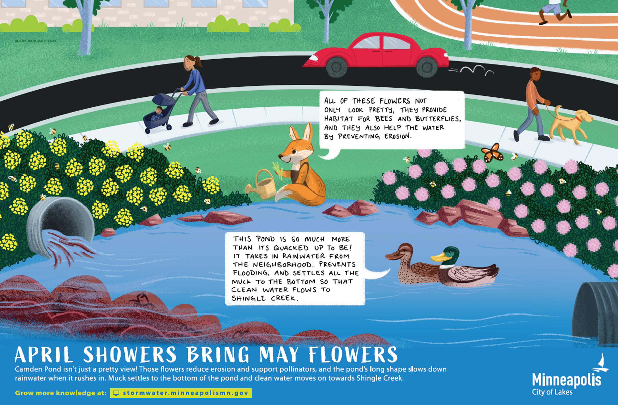
CAMDEN POND
There are 0 signs to explore at this site
Learn more about what this site does:
Remove sediment
LEARN MORE
Slow down flow
LEARN MORE
Reduce flooding
LEARN MORE
Helps pollinators
LEARN MORE
Remove nutrients
LEARN MORE
KEY FACTS:
| Drains to: | Shingle Creek |
|---|---|
| Watershed: | Shingle Creek Watershed Management Commission |
| Sediment Removed: | 27,800 lbs |
| Prosphorus Removed: | 62 lbs |
| Related projects: |
Coming soon |
| History & Culture: | City of Minneapolis Water Resources Land Acknowledgment |
SIGNS AT THE SITE
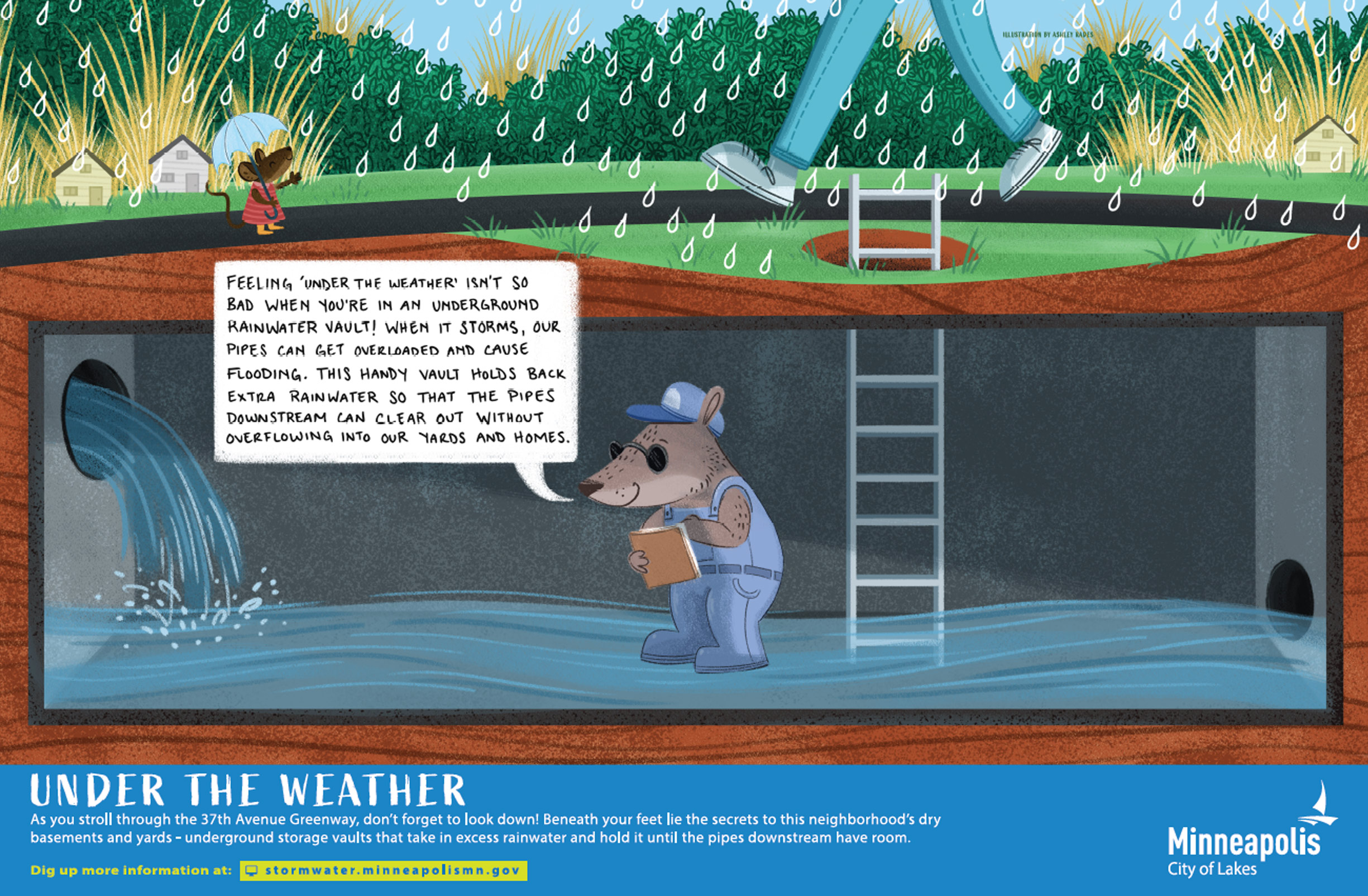
37TH AVENUE GREENWAY
There are 0 signs to explore at this site
Learn more about what this site does:
Remove sediment
LEARN MORE
Slow down flow
LEARN MORE
Reduce flooding
LEARN MORE
Helps pollinators
LEARN MORE
Reduce volume
LEARN MORE
KEY FACTS:
| Drains to: | Crystal Lake |
|---|---|
| Watershed: | Shingle Creek Watershed Management Commission |
| Sediment Removed: | 1,601 lbs |
| Prosphorus Removed: | 3 lbs |
| Related projects: |
Coming soon |
| History & Culture: | City of Minneapolis Water Resources Land Acknowledgment |
SIGNS AT THE SITE

LOWELL CURVE
There are 0 signs to explore at this site
Learn more about what this site does:
Remove sediment
LEARN MORE
Slow down flow
LEARN MORE
Helps pollinators
LEARN MORE
Reduce volume
LEARN MORE
KEY FACTS:
| Drains to: | Bassett Creek |
|---|---|
| Watershed: | Bassett Creek Water Management Organization |
| Sediment Removed: | 502 lbs |
| Prosphorus Removed: | 2 lbs |
| Related projects: |
Coming soon |
| History & Culture: | City of Minneapolis Water Resources Land Acknowledgment |
SIGNS AT THE SITE
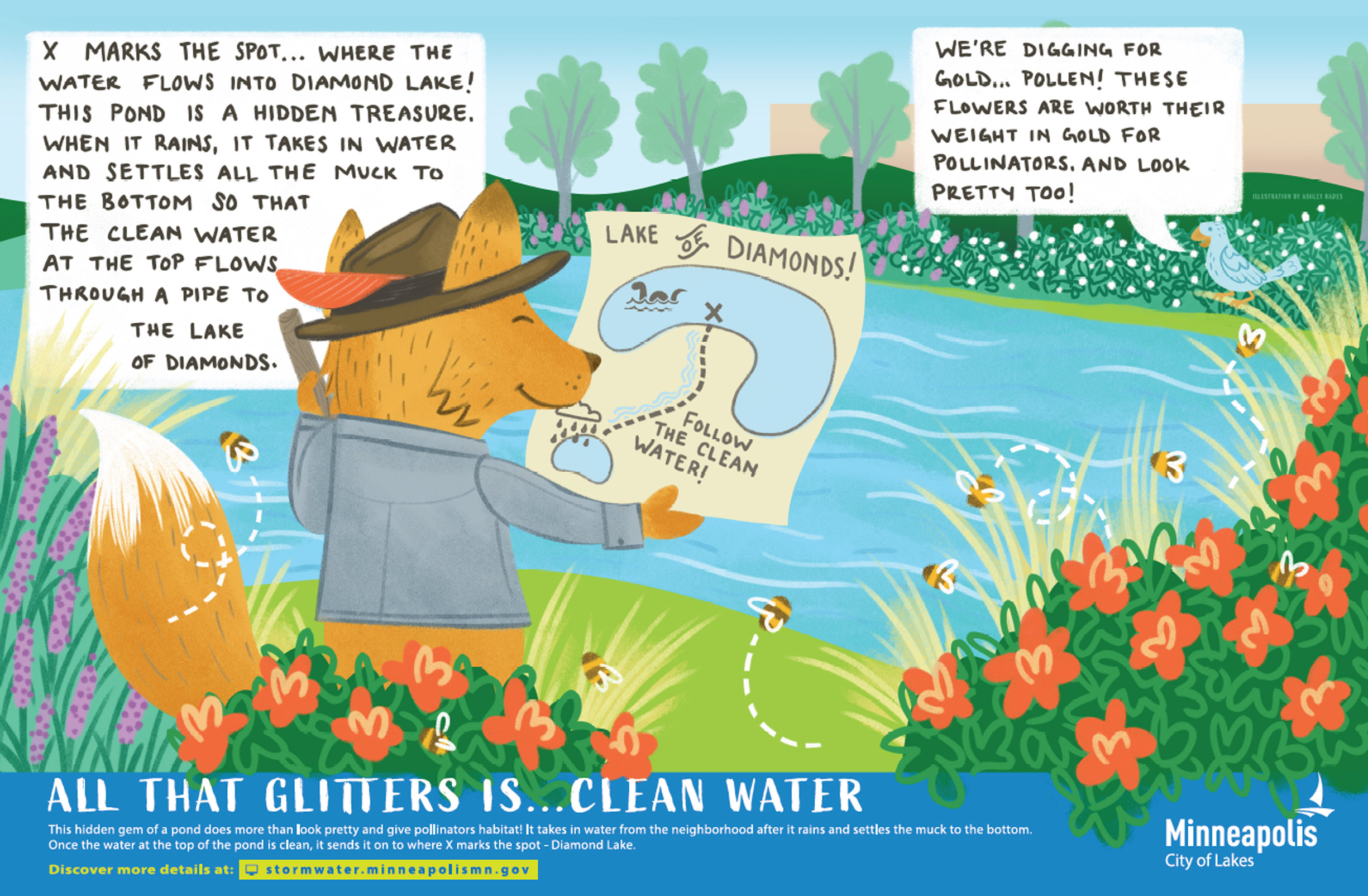
60TH & 1ST AVENUE POND
There are 0 signs to explore at this site
Learn more about what this site does:
Remove sediment
LEARN MORE
Slow down flow
LEARN MORE
Reduce flooding
LEARN MORE
Helps pollinators
LEARN MORE
Remove nutrients
LEARN MORE
Reduce volume
LEARN MORE
KEY FACTS:
| Drains to: | Diamond Lake |
|---|---|
| Watershed: | Minnehaha Creek Watershed District |
| Sediment Removed: | 54,115 lbs |
| Prosphorus Removed: | 106 lbs |
| Related projects: |
Coming soon |
| History & Culture: | City of Minneapolis Water Resources Land Acknowledgment |
SIGNS AT THE SITE
RIVERSIDE RAINGARDEN
There are 0 signs to explore at this site
The signs at this site are not yet installed, but will be coming soon! The sign locations shown on the map are subject to change
Navigate to this site
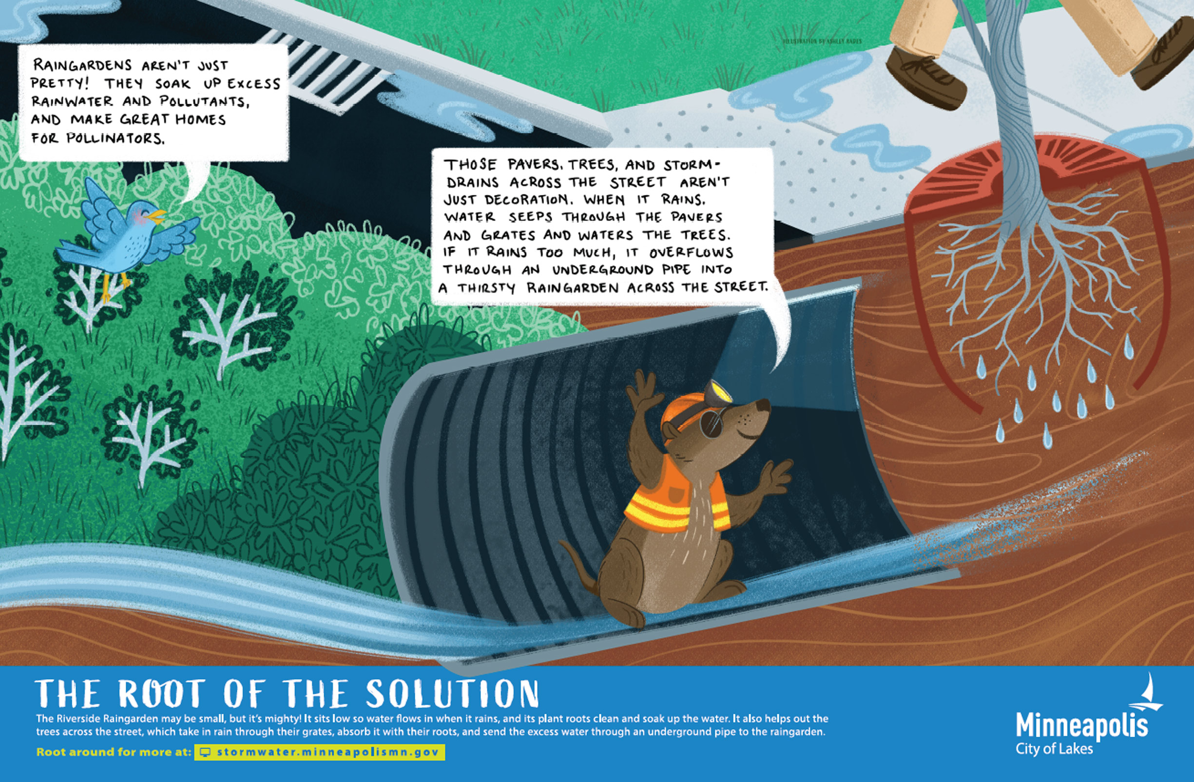
Learn more about what this site does:
Remove sediment
LEARN MORE
Slow down flow
LEARN MORE
Reduce flooding
LEARN MORE
Helps pollinators
LEARN MORE
Reduce volume
LEARN MORE
KEY FACTS:
| Drains to: | Mississippi River |
|---|---|
| Watershed: | Mississippi Watershed Management Organization |
| Sediment Removed: | 582 lbs |
| Prosphorus Removed: | 1 lb |
| Related projects: |
Coming soon |
| History & Culture: | City of Minneapolis Water Resources Land Acknowledgment |
SIGNS AT THE SITE
BURNSIDE'S POND
There are 0 signs to explore at this site
Learn more about what this site does:
KEY FACTS:
| Drains to: | Lake Hiawatha |
|---|---|
| Watershed: | Minnehaha Creek Watershed District |
| Related projects: |
Coming soon |
| History & Culture: | City of Minneapolis Water Resources Land Acknowledgment |
SIGNS AT THE SITE
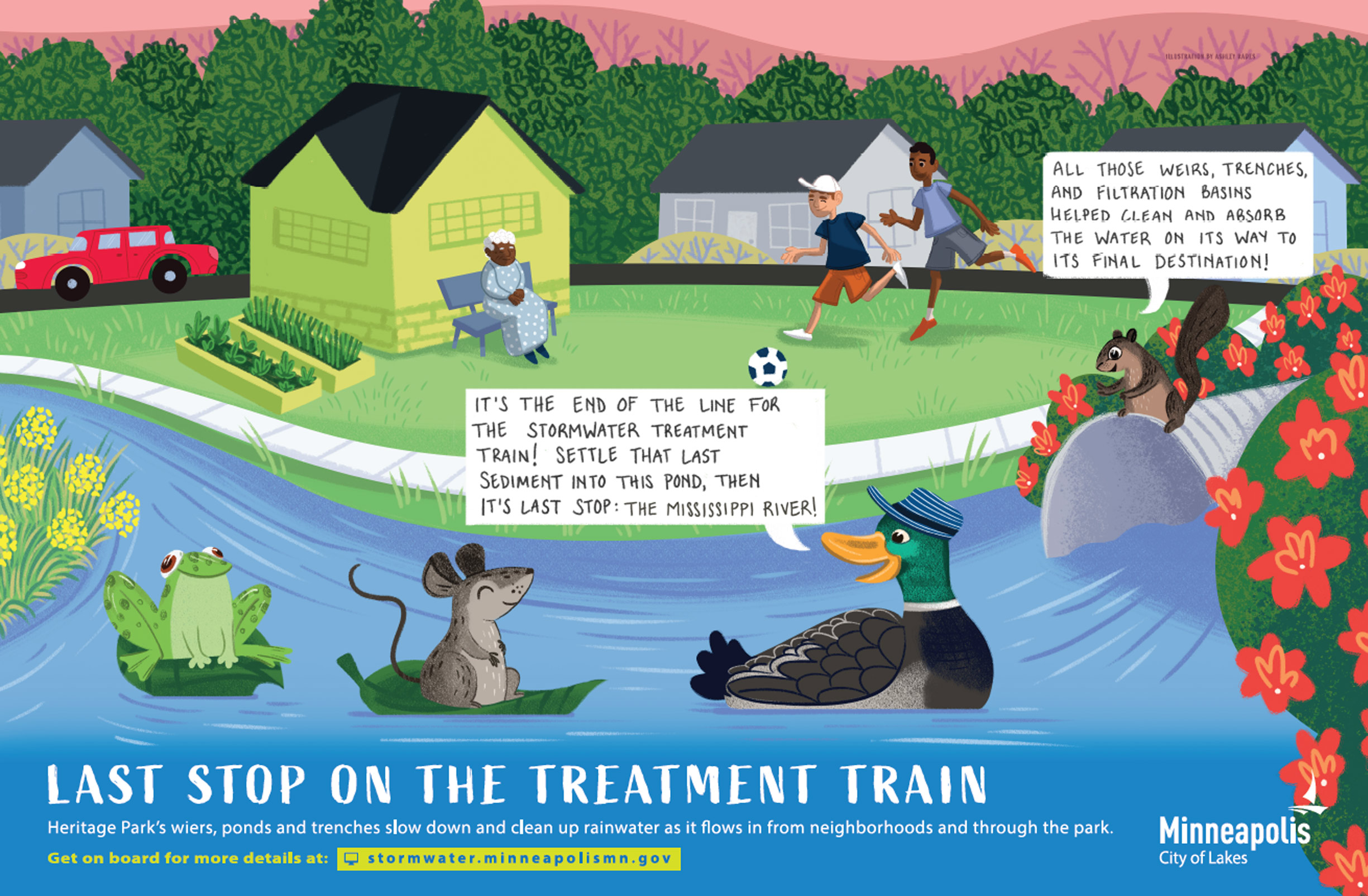
HERITAGE PARK TREATMENT TRAIN
There are 0 signs to explore at this site
Learn more about what this site does:
Remove sediment
LEARN MORE
Slow down flow
LEARN MORE
Reduce flooding
LEARN MORE
Helps pollinators
LEARN MORE
Reduce volume
LEARN MORE
Remove nutrients
LEARN MORE

KEY FACTS:
| Drains to: | Mississippi River |
|---|---|
| Watershed: | Bassett Creek Water Management Organization |
| Sediment Removed: | 25,900 lbs |
| Prosphorus Removed: | 70 lbs |
| Related projects: |
Coming soon |
| History & Culture: | City of Minneapolis Water Resources Land Acknowledgment |
SIGNS AT THE SITE


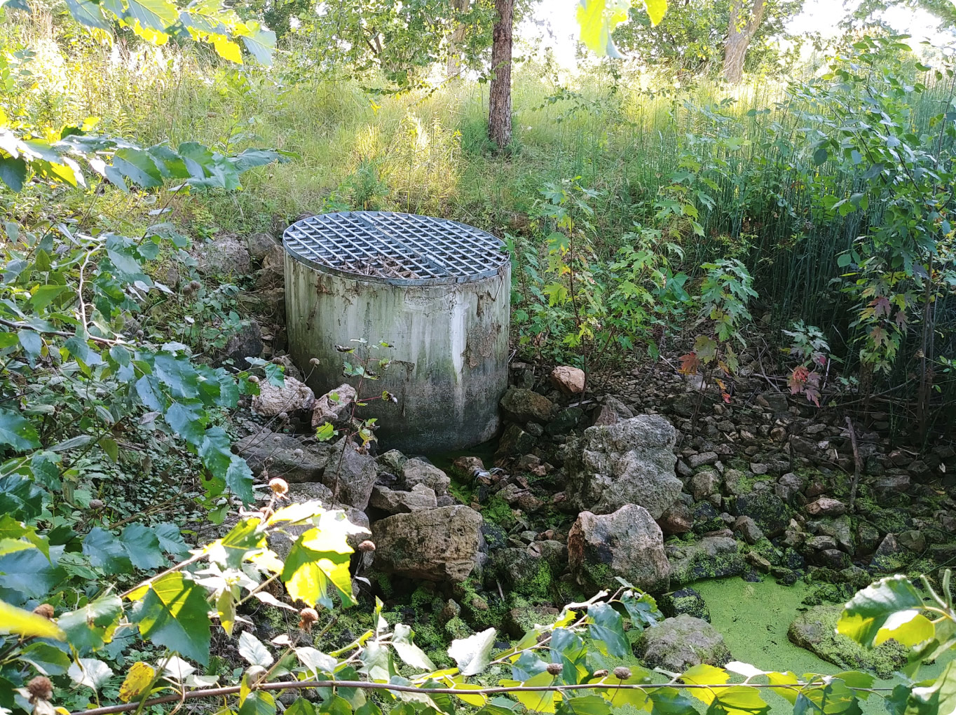
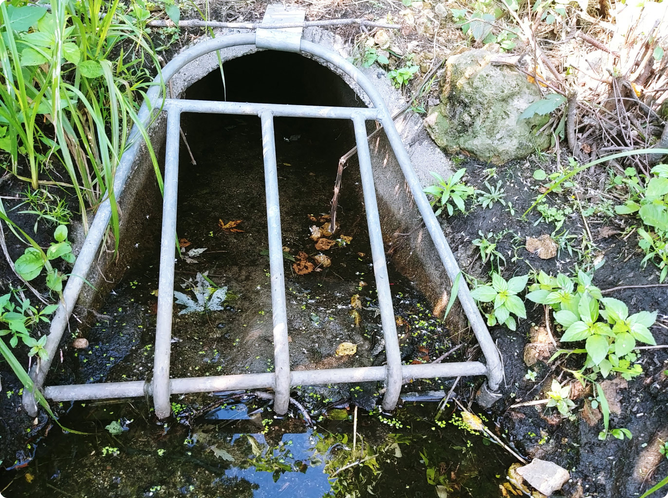
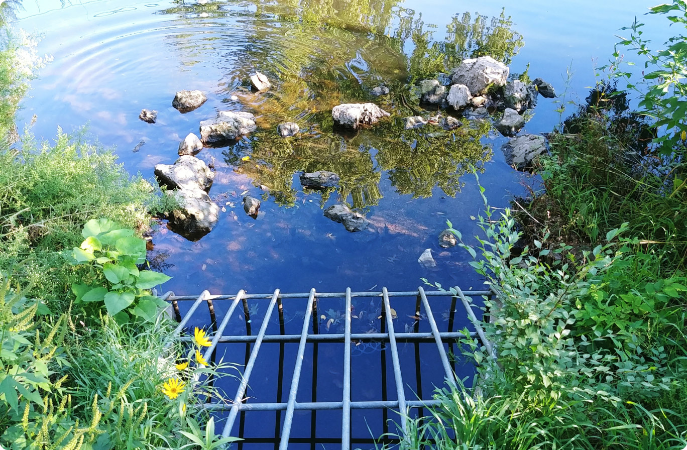
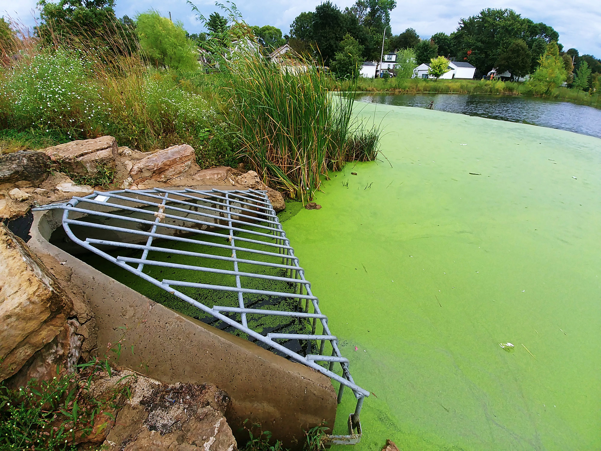
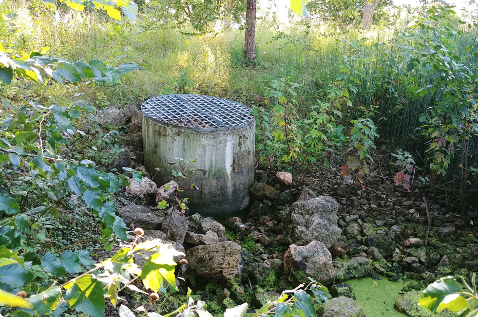
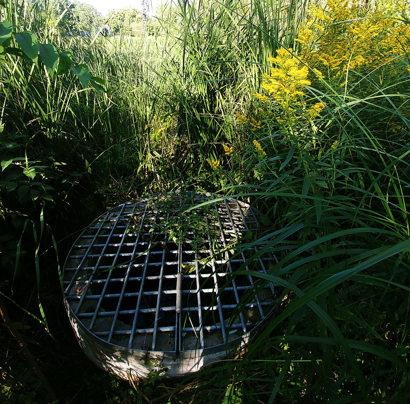
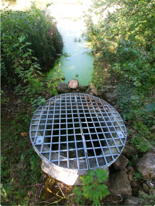
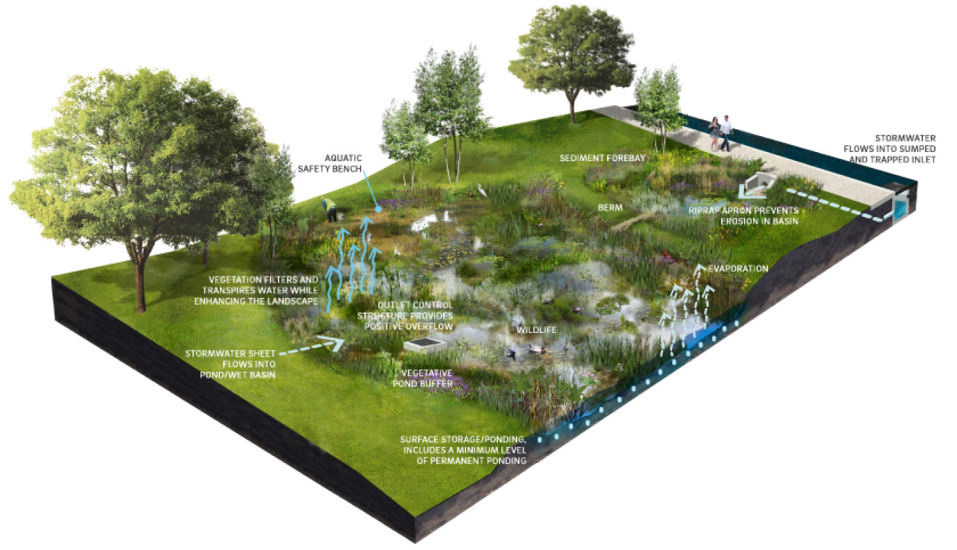
Stormwater Inlet
Inlets are structures at the end of a storm sewer pipe where water flows into a pond, basin, or raingarden. These structures often have trash guards installed to prevent large pieces of debris from entering the pond. Inlets are also designed to help convey the water from the pipe to the pond in a more controlled manner.
Some inlet structures are submerged in the water. Typically, these submerged inlets are connected to pipes that slope downwards but are below street level. The idea is that the water will flow through the pipe as it rains and slowly raise the water level of the pond.

Stormwater Outlets
Outlets are structures that control the flow of water from a pond, basins, and raingardens into the storm sewer system, which conveys the water to a receiving waterbody, like a stream or river.
These outlet structures are often raised in order to only allow water to flow into it when the pond level reaches a certain point. This allows the water in the pond to be held back in order to prevent flooding, to manage how much and how fast water flows to a stream or river, or to allow the water to infiltrate into the ground.
Not all outlets are visible, however. Some are submerged in the water. Typically, these submerged outlets are connected to pipes that slope upwards below the street level. The idea is that the water will slowly back up the pipe as it rains and only enters the storm sewer once the pond has reached a certain water level.
Stormwater Pre-Treatment
There are a few different types of pre-treatment that help clean up water before it enters a pond, basin, or raingarden.
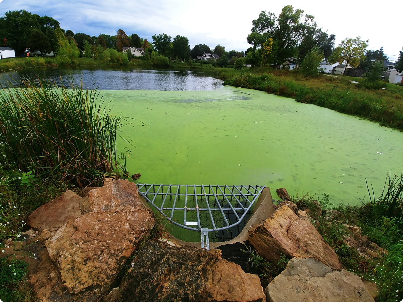
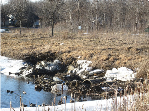
TRASH COLLECTOR
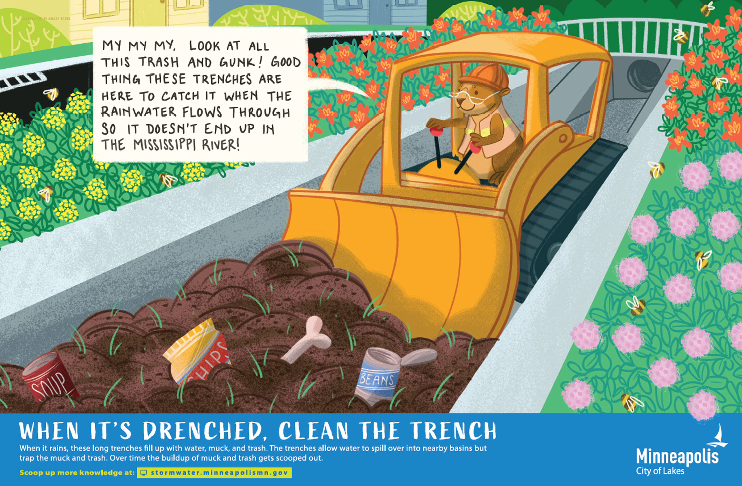
Trash collectors are connected to storm sewer pipes - they provide a detour for larger debris, which collects in a structure below the pipe known as a ‘sump’. Periodically, the City will clean out these trash collectors.
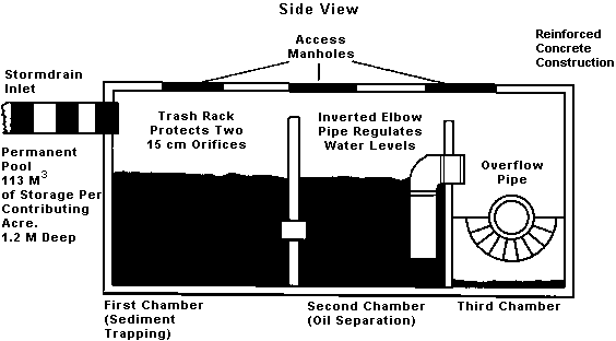
GRIT CHAMBERS
Stormwater grit chambers are tanks installed in the ground that receive water from storm sewer pipes before it reaches the pond. These tanks slow the water down, allowing trash and large debris to collect in the tank. These tanks are periodically cleaned out by the City.
Watch how a grit chamber works
TRASH GUARDS
These are metal bar structures installed on inlets to prevent trash and large debris from entering ponds, basins, and raingardens. These are periodically cleaned out by the City.
EROSION REDUCTION
Some structures are installed to reduce the speed and volume at which water flows into a pond, basin, or raingarden, and to make sure the water is spread out as it enters rather than concentrated on a small area. Lowering speed, volume, and flow area helps reduce erosion. These structures include splash blocks, riprap, and inlets.
Stormwater overflow areas
Sometimes, it rains so much that a back up plan is necessary to make sure excess water has a safe place to go. In the world of stormwater, these contingency plans take the shape of different types of overflows. Some overflows are simply designated areas where water flows from a pond into a nearby basin. Other overflows are underground structures that take in water and direct it through a separate pipe to a stream or river.
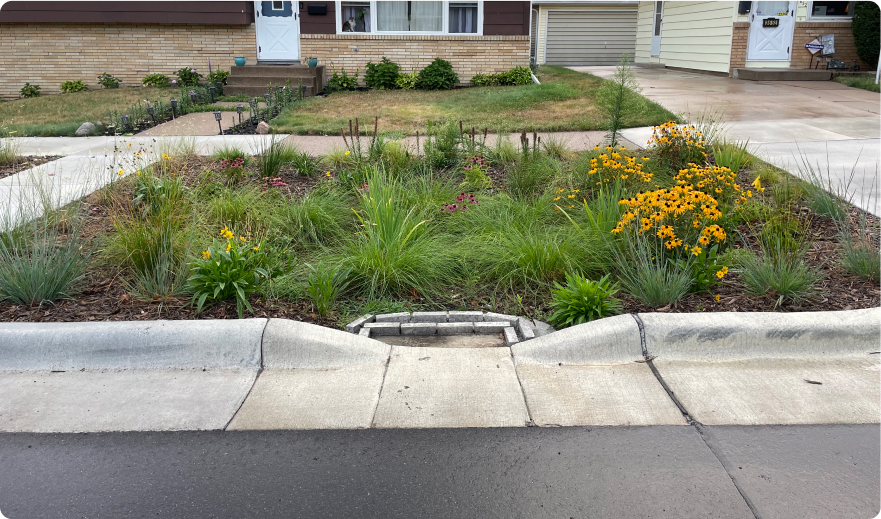
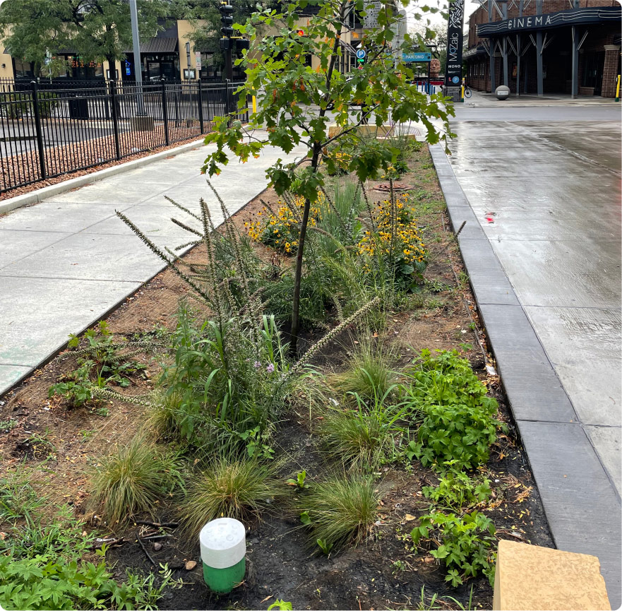
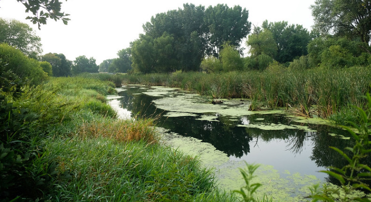
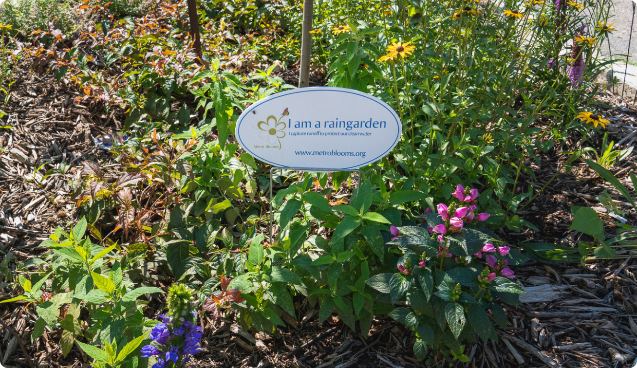
Raingardens
Raingardens are simple, but powerful sotrmwater management tools - and they are beautiful neighborhood features! Raingarden plants soak up excess rainwater with their roots - not only reducing how much runoff goes into nearby streams and lakes, but also gobbling up things like nitrogen and phosphorous that are bad for water quality, but tasty food for plants.
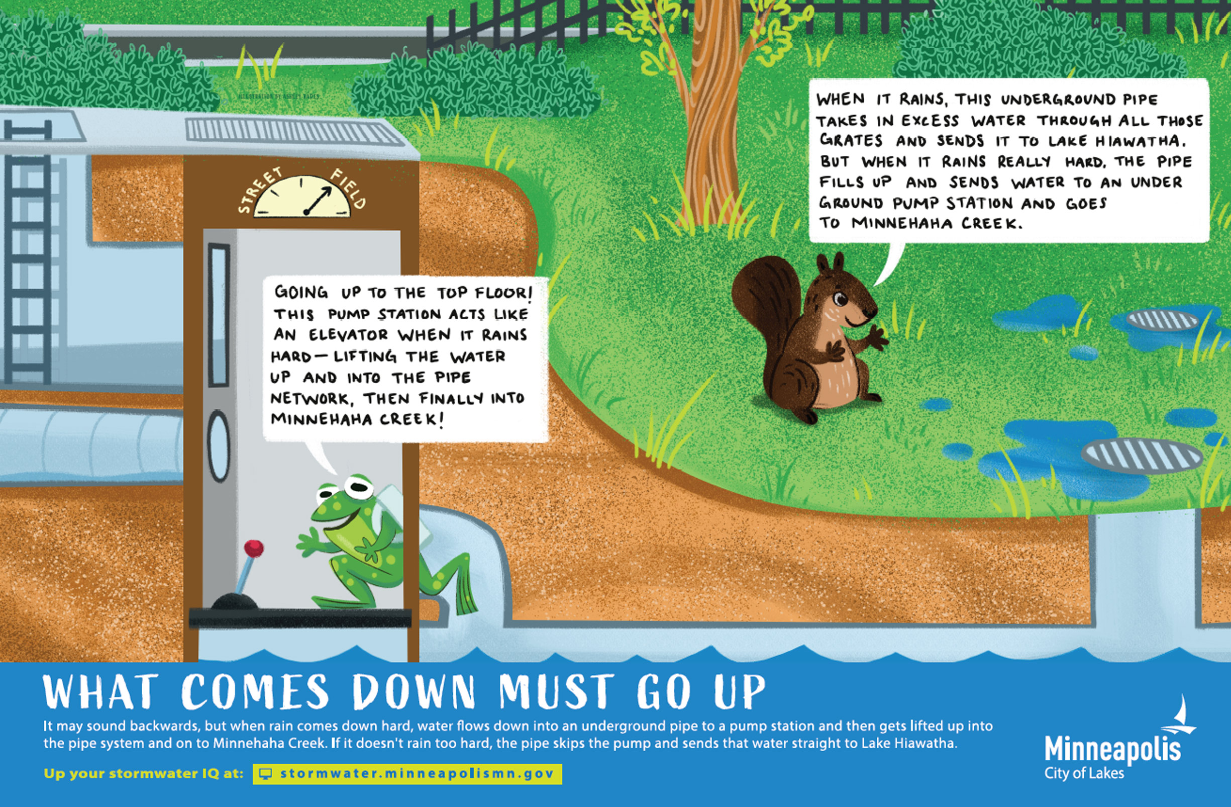
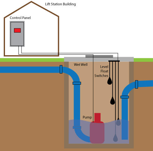
Pump Stations
Stormwater pump stations help protect areas from flooding by pumping away large volumes of excess rainwater from lower elevations to higher elevations, either into a stormwater sewer system, or directly into a receiving body of water like the Mississippi River. The lower depressions are helpful for creating more storage but may not drain naturally without the help of a pump!
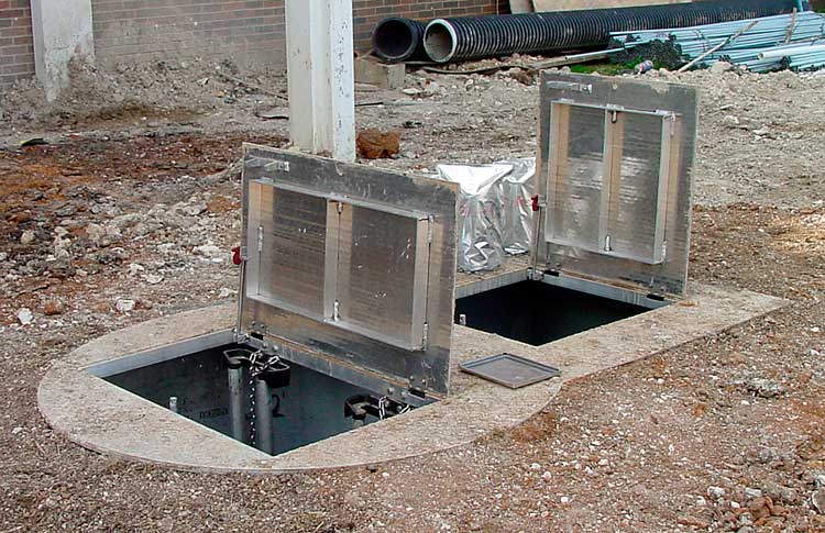
Manholes
We have over 18,000 stormwater manholes in Minneapolis! You may not notice how many pipes run beneath our roads and sidewalks if not for the manholes. Manholes allow access to the underground piped systems for maintenance and repair. Catch basins help protect our pipes by removing sediment, organics, oil, grease, trash, road salt, and other pollutants that would have otherwise gotten stuck in the pipes.

Dry detention basins
Dry detention basins look like grassy fields, but they do much more. They collect and hold rainwater so it doesn’t flood the neighborhood around it. Then they slowly absorb the rainwater, cleaning it up and sending a nice, slow flow of water to a creek, lake, or river.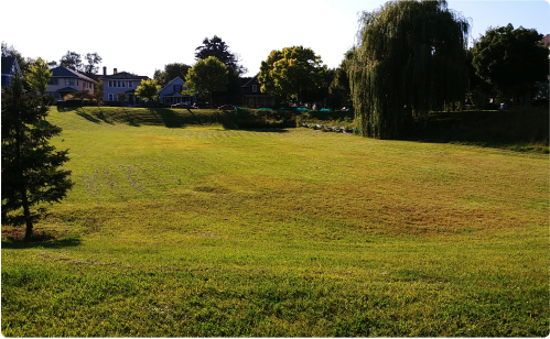
Equalizer Pipes
Equalizer pipes help equalize the water levels between ponds that work together to take in stormwater when it rains. Typically when ponds are interconnected, one pond receives stormwater from streets and neighborhoods when it rains, and if that pond’s water level increases enough, the excess water will flow through a connector pipe to the connected pond to ensure the receiving pond does not overflow.
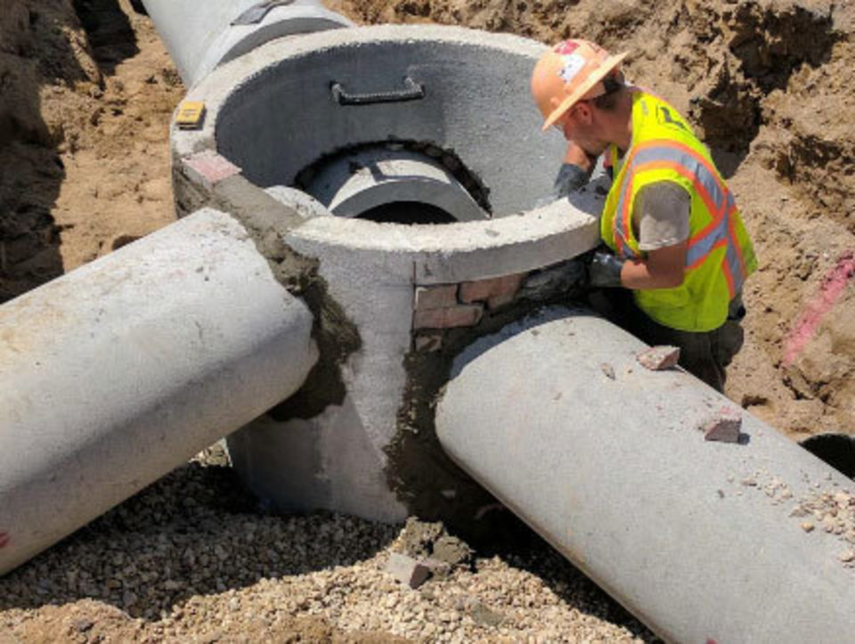
Connector Pipes
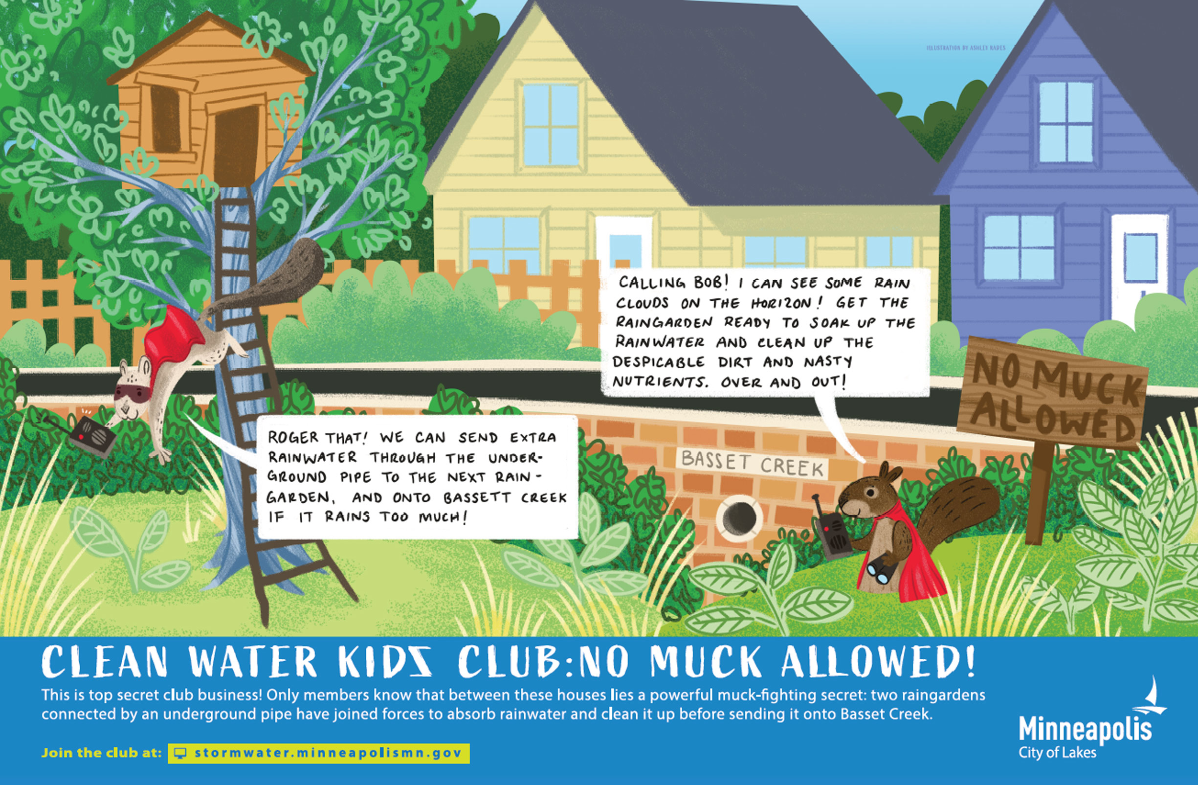
Connector pipes help connect more than one pond together to create a step-by-step process for stormwater to flow through. When ponds are interconnected, one pond receives stormwater from streets and neighborhoods when it rains, allows sediment to settle to the bottom and slows down flow, and then passes cleaner water to the next pond through a connector pipe. That next pond settles more sediment to the bottom and passes even cleaner water into an outlet to a creek or the River.
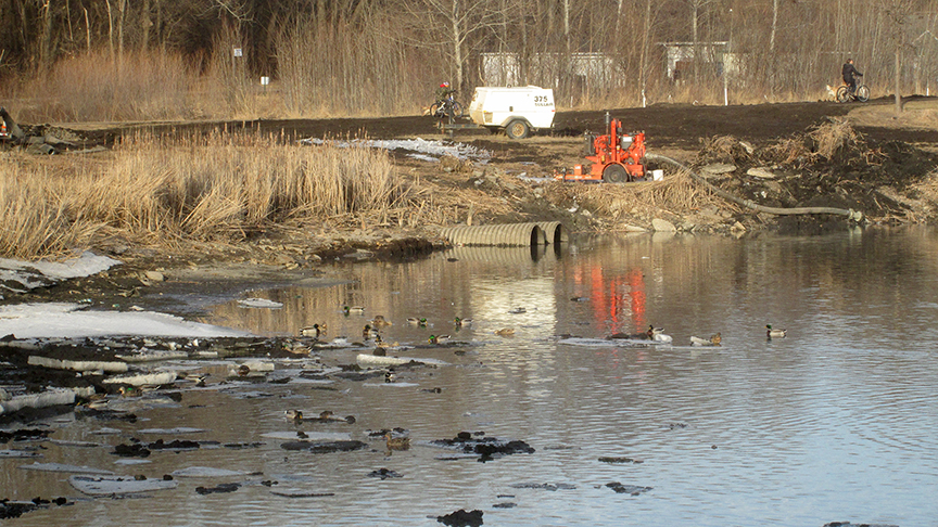
PONDS
How do ponds help us manage stormwater?
Stormwater ponds are designed to capture stormwater runoff from streets, sidewalks, and roofs to help mitigate flooding and improve water quality in urban areas.
Sites with ponds


INFILTRATION BASINS

How do infiltration basins help us manage stormwater?
Also called “dry ponds”, infiltration basins often look like low-lying grassy areas that are often used for neighborhood sports and recreation when they are dry, which is most of the time. However, during some heavy rainstorms, these “dry” ponds, or infiltration basins, will temporarily become “wet” ponds as they fill with runoff from streets, pipes, and nearby wet ponds.
But don’t worry! You can get back to your soccer game soon enough - infiltration basins are designed to absorb stormwater (cleaning it up along the way!) into the ground so that it flows underground to nearby streams and lakes.
Sites with ponds
RAINGARDENS
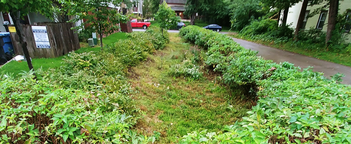
How do raingardens help us manage stormwater?
Raingardens are simple, but powerful sotrmwater management tools - and they are beautiful neighborhood features! Raingarden plants soak up excess rainwater with their roots - not only reducing how much runoff goes into nearby streams and lakes, but also gobbling up things like nitrogen and phosphorous that are bad for water quality, but tasty food for plants.
Sites with raingardens


REMOVE SEDIMENT
CLEANING UP DIRTY WATER
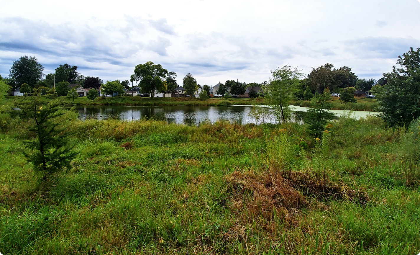
Ponds, infiltration basins, and raingardens are examples of green stormwater infrastructure throughout Minneapolis. One of their most important jos is to remove sediment and garbage to keep our water clean.
PONDS
Ponds clean rainwater runoff by catching big pieces of trash in grit chambers before the water enters the pond. Smaller items that pass through including smaller garbage and sediment will settle to the bottom of the pondusually to be dredged out later. The now-clean water at the top of the pond flows out the streams and river.
INFILTRATION BASINS
Infiltration basins absorb rainwater as it falls. As the water moves down through the dirt and sand on its slow journey through the ground to our streams and rivers, sediment and garbage gets left behind on the surface.
RAINGARDENS
Raingardens also absorb rainwater as it falls. The water gets absorbed by the garden’s thirsty plants through their roots and through the ground beneath the plants. The plant roots take in nutrients like nitrogen and phosphorous that are harmful to fish and other aquatic life, while the ground beneath the garden filters out sediment as the water makes its slow journey through the ground to our streams and rivers.
SLOW DOWN FLOW
PREVENTING EROSION AND FLOODING
The ponds, infiltration basins, and raingardens are examples of green stormwater infrastructure throughout Minneapolis. These facilities keep rainwater closer to where it fell. This allows the rainwater to seep back into the soil and reduce the power of fast moving runoff.
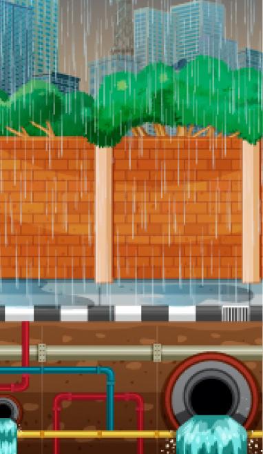
WHY IS FAST-MOVING RUNOFF BAD?
When it rains in an urban area like Minneapolis, stormwater falls on surfaces like roofs, streets, and parking lots.
These surfaces are impervious, which means they cannot absorb the rain – instead when water falls on a street, water runs off and collects into our stormwater pipe system. The stormwater pipe system empties into streams and rivers.
This collection of water rushing into our pipes and dumping out into our streams and rivers is fast and powerful. This water can rise quickly, causing flooding in our neighborhoods and erosion into our streams and rivers.
REDUCE FLOODING
STAYING DRY
The ponds, infiltration basins, and raingardens are examples of green stormwater infrastructure throughout Minneapolis. Making sure our neighborhoods don’t flood is one of their most important jobs.
PONDS
Ponds prevent flooding by giving excess rainwater a place to go. Instead of into our yards and basements, rainwater collects in these ponds, which hold the water and then release it at a slow and steady pace through outlet structures and pipes into our streams and rivers.
INFILTRATION BASINS
Infiltration basins prevent flooding by transforming into temporary ponds when there is a lot of rainwater to hold. They then slowly absorb rainwater through the ground.Some basins also have outlet structures that connect to pipes to transfer the water slowly and steadily into our streams and rivers./p>
RAINGARDENS
Raingardens prevent flooding by absorbing rainwater both into its plants, and through the ground. The water then is used by the plants, or slowly makes its way through the ground to our streams and rivers.
REDUCE VOLUME
LESS WATER TO MANAGE
The infiltration basins and raingardens are examples of green stormwater infrastructure throughout Minneapolis. Reducing the amount of water that flows into our storm sewer system is one of their most important jobs.
ABSORBING RAINWATER
Infiltration basins and raingardens reduce the amount of stormwater that enters our sewer system by absorbing rainwater as it falls. The water collects in these basins and gardens and slowly travels through the ground and into our streams and rivers. This process takes place over a longer period of time than water rushing through a pipe. When more runoff is directed to green stormwater infrastructure, there is less water directed to the pipes. This means the amount of water in the pipes has less power.
REMOVE NUTRIENTS
FEEDING THE PLANTS
Raingardens are examples of green stormwater infrastructure throughout Minneapolis. Reducing the amount of harmful nutrients like nitrogen and phosphorous that get into our rainwater runoff through yards and streets is one of their most important jobs.
BAD FOR WATER, GOOD FOR PLANTS
While nitrogen and phosphorous can be harmful to fish and other aquatic life, plants see these nutrients and food. Raingardens help absorb these nutrients through their plant roots before the rainwater flows through the ground and into our streams and rivers.
POLLINATOR GARDENS
Who are our pollinators?
Bees & insects
 Bees & insects
Butterflies & moths
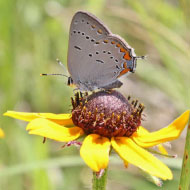 Butterflies & moths
Birds
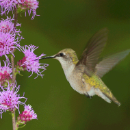 Birds
Birds
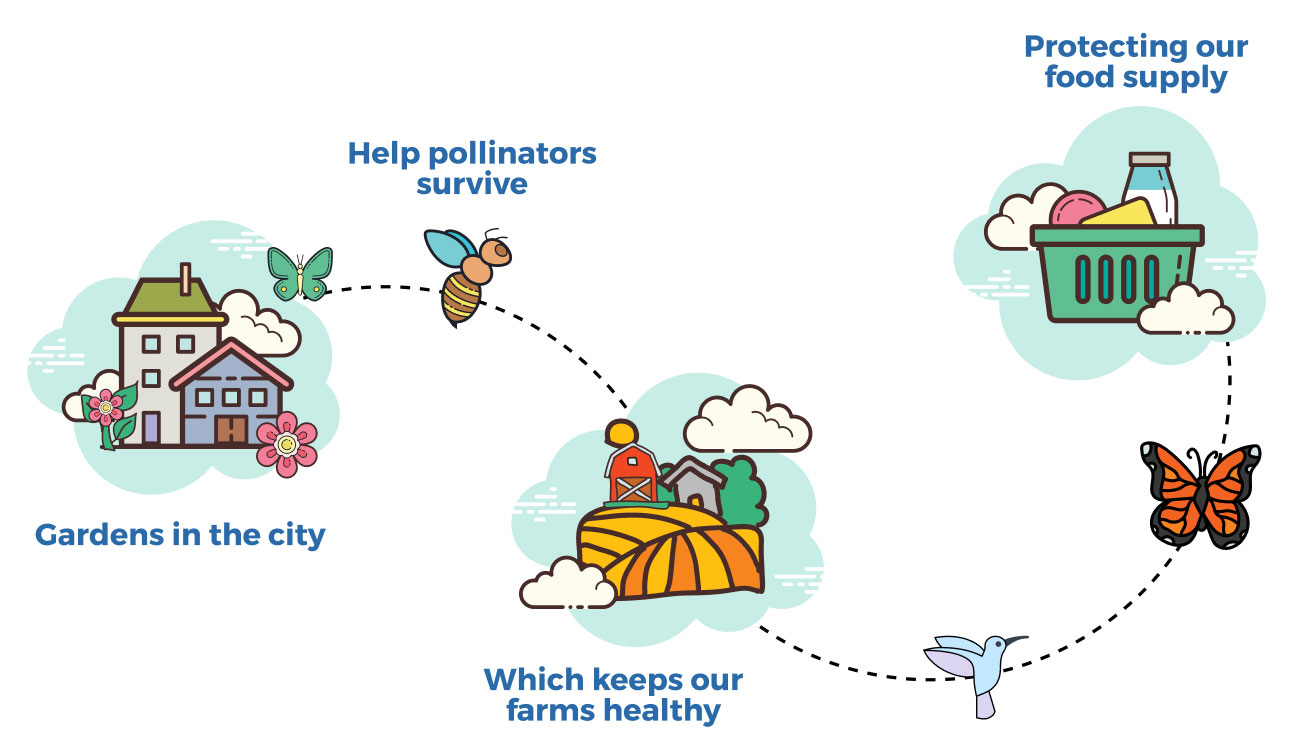
Why are pollinators important?
LPollinating animals visit flowers to drink nectar or feed off pollen. This process is critical in helping plants reproduce, even for some of the food we eat! Plants need pollinators to help them produce seeds, fruits, and the next generation of plants.
How do our pollinator gardens help?
The gardens in the city provide a safe habitat to help pollinators survive. Healthy populations of pollinators keep our farms healthy and protect the supply of food that we eat!
DRAINAGE AREA
What is a drainage area?
A drainage area is a section of land where rain or snow melt collects and drains into one common outlet, such as pond.
In urban areas, the drainage areas are determined by the storm sewer systems that collect and convey stormwater runoff. In more rural areas, drainage areas are determined by the landscape, and where water naturally flows to an outlet.
Large-scale drainage areas are also called watersheds. In Minneapolis, there are four watersheds:
WATERSHED: Bassett Creek Water Management Organization
About BCWMC
The Bassett Creek Watershed Management Commission adopted its current Watershed Management Plan (the Plan) at its September 16, 2004 meeting.
This "second generation" plan was prepared in compliance with the provisions of the Minnesota Rules Chapter 8410, the Metropolitan Surface Water Management Act, the Water Resources Management Policy Plan, and other approved regional plans. The Plan was approved by the Minnesota Board of Water and Soil Resources on August 25, 2004. The Plan sets the vision and guidelines for managing surface water within the boundaries of the BCWMC.
Visit website

WATERSHED: Minnehaha Creek Watershed District
About MCWD
Minnehaha Creek Watershed District is a local unit of government responsible for managing and protecting the water resources in one of the largest and most heavily-used urban watersheds in Minnesota.
The watershed stretches 178-square miles from St. Bonifacius to south Minneapolis and includes Lake Minnetonka, the Minneapolis Chain of Lakes, Minnehaha Creek, and Minnehaha Falls. It includes eight major creeks, 129 lakes, and thousands of wetlands.
Visit website
WATERSHED: Mississippi Watershed Management Organization
About MWMO
The MWMO is a public organization that partners to protect and improve water and habitat in our urban watershed. We invest in people and infrastructure to support clean water, and provide knowledge, scientific data and expertise to help manage our vital water resources.
Visit website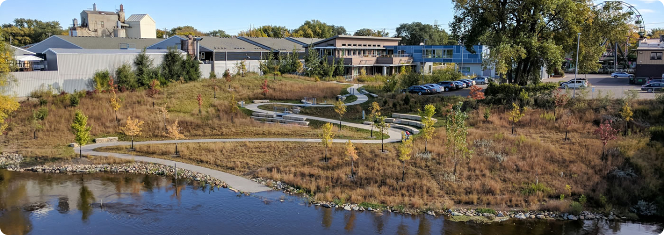
WATERSHED: Shingle Creek Water Management Commission
About Shingle Creek WMC
The Shingle Creek WMC works to improve water quality, prevent flooding and erosion from surface flows, promote groundwater recharge, protect and enhance fish and wildlife habitat and water recreation facilities, reduce the public capital expenditures necessary to control excessive volumes and rate of runoff, and to improve water quality.
Visit website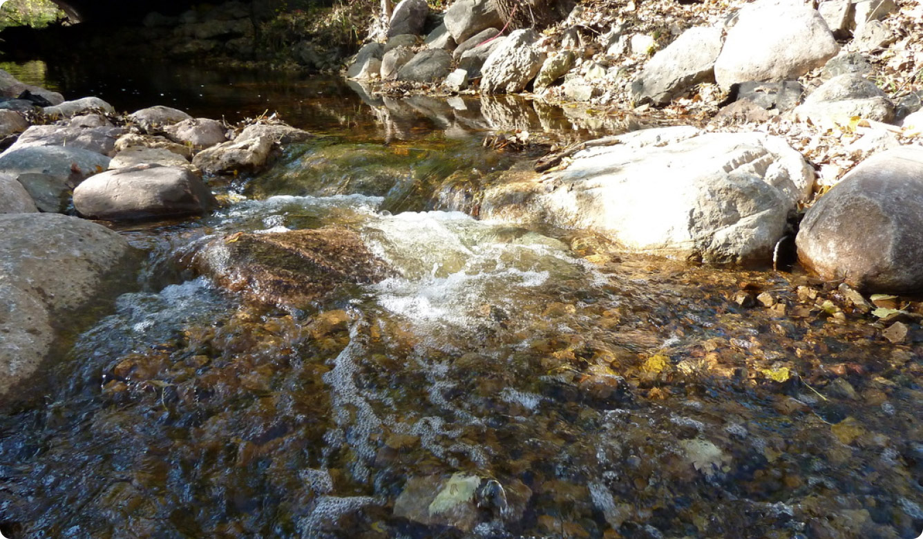
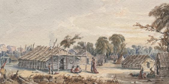 Dakota Summer Village, c. 1847 (Seth Eastman, MNHS Neg. No. 12700)